Understanding Real Estate Drone Photography
Real estate drone photography has revolutionized the way properties are marketed and showcased. By utilizing advanced unmanned aerial vehicles (UAVs), agents and property owners can present listings from a fresh, dynamic perspective that captures the full scope of a property's surroundings and unique features. Unlike traditional photography methods, drone imagery offers high-resolution, wide-angle views that highlight both the property's interior and exterior, including landscaping, proximity to amenities, and neighborhood characteristics.
This form of photography has become an essential component of modern property marketing strategies. It allows potential buyers to virtually explore a property in ways that were previously impossible, fostering stronger visual engagement and confidence in the property's value. For instance, aerial shots can accurately display the layout of sprawling estates, waterfront properties, and commercial real estate, providing comprehensive insights that facilitate faster and more informed decision-making.
Furthermore, real estate drone photography can be integrated with virtual tours and 3D mapping, offering immersive experiences for remote clients. This multidimensional approach not only improves visibility but also sets listings apart in a competitive market. The ability to showcase a property's most appealing attributes from elevated angles provides a strategic advantage, increasing engagement and accelerating sales timelines.
In markets like Miami, where luxury estates and scenic waterfront properties are prevalent, the visual impact of aerial photography is particularly pronounced. High-quality drone shots emphasize the unique aspects of these properties—expansive pools, private docks, lush landscaping, and breathtaking views—making them particularly attractive to discerning buyers looking for exclusive homes or investment opportunities.
As drone technology advances, the resolution and stability of aerial images continue to improve, offering even more detailed and captivating visuals. Whether for residential, commercial, or industrial real estate, the strategic use of drone photography enhances overall marketing efforts, providing comprehensive, appealing narratives that traditional methods cannot easily replicate.
Legal and Regulatory Considerations in Miami
When implementing real estate drone photography in Miami, adherence to official protocols and obtaining necessary authorizations is a fundamental component of operational planning. Drone pilots and photography service providers must familiarize themselves with the specific requirements set forth by the Federal Aviation Administration (FAA) as well as local municipal guidelines to ensure compliant practices throughout the shooting process.
In Miami, drone operators are required to obtain an FAA Remote Pilot Certificate to legally fly commercial unmanned aircraft systems (UAS). This certification involves passing a comprehensive aeronautical knowledge exam, demonstrating proficiency in topics such as airspace rules, weather considerations, and safe drone operation. Alongside federal certification, operators should also secure any local permits or permissions if operating in designated sensitive zones or within restricted airspace. This often entails coordinating with Miami’s municipal authorities or property owners to avoid interference with air traffic or other restricted zones.
For property owners and real estate agents, collaborating with licensed drone service providers ensures that aerial footage collection complies with all established regulations. It also helps mitigate risks related to unauthorized flights or violations of privacy rights, which are increasingly scrutinized in densely populated urban settings like Miami. Creating a clear, documented agreement before a drone flight not only facilitates smooth execution but also maintains professionalism and adherence to legal standards.
Operators should stay informed about temporary flight restrictions (TFRs), especially during major events or emergencies, which can impact drone flight plans. Additionally, respecting privacy by avoiding intrusion into private spaces and maintaining a safe distance from individuals ensures ethical practice and preserves the reputation of drone photography services. With proper planning and communication, aerial real estate imagery can be captured effectively without breaching official guidelines or operational protocols.
Understanding Real Estate Drone Photography
Real estate drone photography has transformed how properties are showcased in Miami's competitive market. By employing unmanned aerial vehicles equipped with high-resolution cameras, real estate professionals can present properties from angles and perspectives previously difficult to achieve through traditional photography. These images and videos highlight the property's surroundings, architecture, and scale, offering potential buyers a comprehensive visual experience that engages and informs. As technology advances, drone imagery is becoming a vital tool for real estate marketing strategies, providing dynamic content that captures attention in online listings and promotional materials.
Utilizing drone photography not only elevates the aesthetic appeal of property listings but also assists in demonstrating the property's proximity to local amenities, scenic views, or waterfront access—features that significantly influence buyer interest. With planning and precision, aerial imagery encapsulates the property's essence, helping sellers attract qualified buyers and facilitating faster sales. Properly executed, drone shots incorporate stark contrasts and intricate detail that elevate standard visual approaches, making properties stand out in Miami’s bustling real estate landscape.
Legal and Regulatory Considerations in Miami
Ensuring all operations are conducted within established frameworks allows real estate professionals to harness the full potential of drone photography while maintaining professionalism and operational integrity. In Miami, drone operators should obtain necessary certifications and familiarize themselves with local airspace rules. Working with licensed drone service providers is crucial for compliance, as it assures adherence to safety standards and privacy considerations. These professionals understand permitted flight zones, temporary flight restrictions (TFRs) during major local events, and protocols for operating near sensitive sites or private residences.
Property owners and real estate agents benefit from collaborating with experienced drone operators, as they can facilitate the necessary permissions related to specific properties or neighborhoods. Establishing clear agreements prior to shoots reduces misunderstandings and ensures that all aerial captures are obtained ethically and within legal parameters. This proactive approach enhances efficiency, minimizes risks, and preserves the reputation of all parties involved.
Operators should also stay informed about temporary flight restrictions (TFRs), particularly during high-profile events or emergencies, which can restrict drone access to certain areas. It’s equally important to respect privacy boundaries by avoiding unnecessary intrusion into private spaces and maintaining a safe distance from individuals. Ethical practices foster trust with clients and the community, solidifying the reputation of drone services within the competitive Miami market. Through careful planning, communication, and adherence to official protocols, aerial imagery can be captured safely and effectively, elevating real estate presentations without compromising regulatory standards.
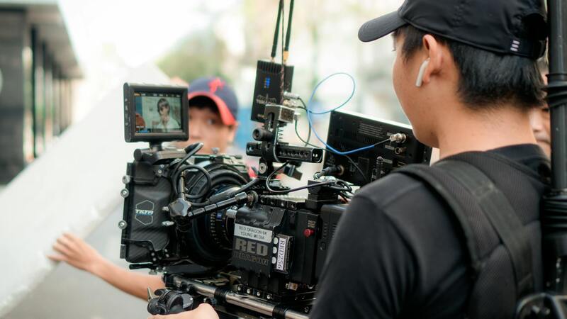
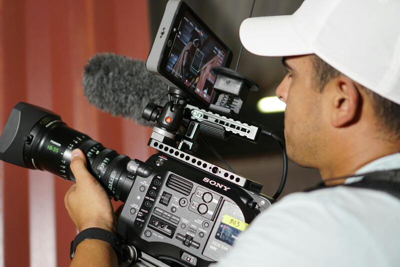
Equipment and Technology for Drone Photography
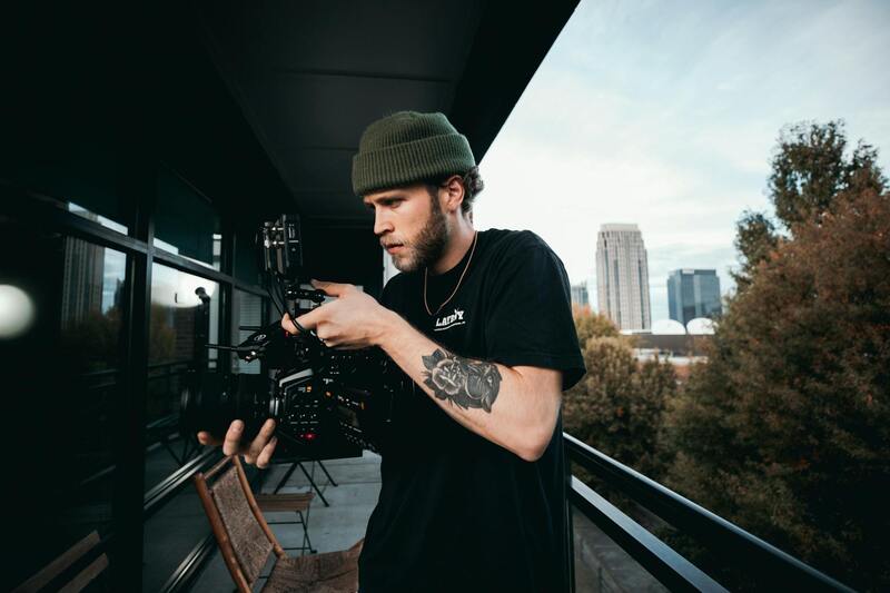
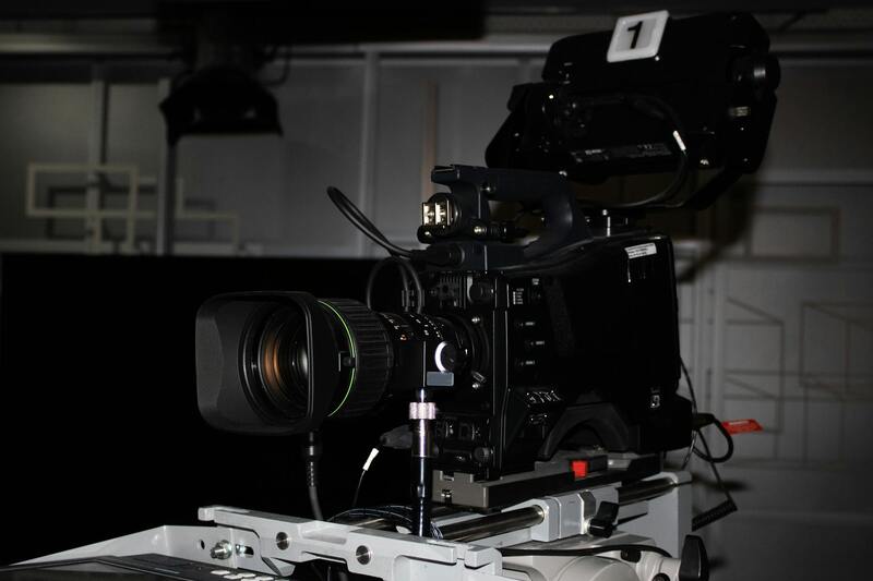
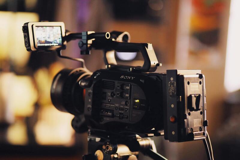
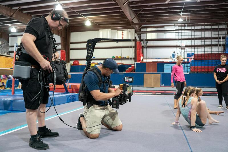
Choosing the right equipment is fundamental to capturing high-quality real estate drone imagery that effectively showcases properties in Miami’s competitive market. Essential drone technology includes advanced UAVs equipped with high-resolution cameras capable of capturing detailed images and smooth video footage from various altitudes and angles. Modern drones often incorporate gimbal stabilization systems, which are critical for maintaining image sharpness and reducing vibrations during flight, resulting in professional-grade visuals.
Camera specifications matter significantly; sensors with larger sizes and higher megapixel counts enable clarity and detail, especially in high-dynamic-range situations where balancing light and shadow is key. Additionally, drones with adjustable aperture settings provide greater control over exposure, ensuring optimal lighting conditions regardless of weather or time of day.
Flight stability features such as GPS-assisted hovering, obstacle avoidance systems, and automated flight modes contribute to safer operations and more consistent results. Incorporating thermal imaging or LiDAR technology, although less common, can also enhance real estate presentations by providing unique perspectives or detailed topographical data.
Battery technology is equally important; long-lasting batteries with rapid charging capabilities maximize flight time and efficiency during shoots. Some drones support swappable batteries, allowing for extended sessions without lengthy pauses, ultimately boosting productivity and ensuring comprehensive coverage of large properties or extensive developments.
Operator control systems and software play a role in pre-planning flight paths, managing camera angles, and ensuring smooth footage capture. Advanced flight planning tools integrate geographic information, maps, and real-time weather conditions to optimize missions, reduce risks, and improve overall shot quality.
Emerging Technologies and Future-Ready Equipment
- Integration of artificial intelligence for automated shot framing and focus adjustments
- Enhanced obstacle detection for complex urban environments
- Higher density aerial sensors for ultra-high-definition imaging
- Cloud-based data management and remote operation capabilities
Investing in latest-generation drones and accessories not only guarantees compatibility with evolving industry standards but also ensures that real estate professionals stay competitive by offering visually impressive, precise, and impactful imagery to clients in Miami's vibrant property market.
Advanced Techniques for Enhancing Aerial Imagery
To produce visually compelling real estate visuals, utilizing advanced drone photography techniques is essential. One such method involves strategic timing to capture properties during optimal lighting conditions. Golden hour, occurring shortly after sunrise or before sunset, provides soft, warm light that enhances property features and minimizes harsh shadows, resulting in more appealing images. Conducting flights during these periods can significantly increase the aesthetic value of the shots.
Another technique revolves around multi-angle shooting. By capturing images from various altitudes and angles, photographers can create comprehensive visual narratives of a property. Incorporating both oblique and straight-down shots offers prospective buyers a multidimensional view, highlighting the property's size, layout, and surrounding environment.
High-dynamic-range (HDR) imaging is also a valuable tool in drone photography. HDR combines multiple exposures to create images with balanced lighting, capturing details in both shadows and highlights. This approach ensures that property images appear vibrant and true to life, especially in areas with contrasting lighting conditions.
Furthermore, implementing pole or drone-mounted shot rigging can enable the stabilization of footage, reducing vibrations and motion blur. Smooth, steady visuals elevate the overall quality of the imagery and contribute to a more professional presentation.
Optimizing Flight Planning for Maximum Impact
Thorough flight planning is critical to ensure comprehensive coverage of a property and its surroundings. Utilizing specialized mapping software allows for precise pre-flight routes, avoiding obstacles and targeting key features such as swimming pools, landscaping, and architectural details. Incorporating GPS technology helps maintain consistent altitude and positioning, which is vital for producing uniform shots throughout a shoot.
Weather conditions, including wind speed, precipitation, and sunlight, should be meticulously monitored before each flight. Adjusting plans to fit environmental conditions helps mitigate risks and ensures the safety of equipment and personnel.
Incorporating automated flight modes, such as waypoint navigation, can streamline the process, enabling capturing of complex shots from multiple angles without constant manual control. This approach provides consistent results and reduces operator fatigue.
Properly documented flight paths and camera angles facilitate post-processing workflows, allowing editors to precisely align footage and seamlessly stitch images for panoramic views or virtual tours.

Understanding Real Estate Drone Photography
Real estate drone photography has revolutionized how properties are marketed, providing high-impact visuals that capture the attention of potential buyers. This specialized form of aerial imaging offers a unique perspective, revealing the full scope of a property's layout, landscaping, and surrounding amenities. By utilizing advanced drone technology, real estate professionals can create compelling visual narratives that emphasize key selling points, such as expansive yards, waterfront access, or architectural grandeur. The dynamic and cinematic quality of drone footage sets listings apart in a competitive market, fostering increased engagement and interest from prospective buyers.
Achieving this level of visual impact requires a deep understanding of drone operation, camera settings, and composition principles. Proper planning ensures that the footage highlights the property’s best features while minimizing distractions such as clutter or unflattering angles. When executed correctly, real estate drone photography not only enhances listings but also facilitates faster sales by providing an authentic preview that nurtures buyer confidence. Moreover, immersive views created through 3D mapping or virtual tours can further elevate the property's presentation, offering an interactive experience that captivates potential clients and provides comprehensive insights into the property’s layout and surroundings.
Best Practices for Capturing Effective Real Estate Shots
To maximize the impact of drone footage, it’s imperative to follow structured procedures during the shoot. Here are several best practices:
- Pre-shoot Planning: Study satellite imagery and property blueprints to determine optimal flight paths that cover all relevant angles. Identify focal points such as pools, gardens, or architectural features that should be emphasized.
- Lighting and Weather Conditions: Schedule flights during times of optimal natural lighting — typically early morning or late afternoon — to add warmth and depth to footage. Weather should be clear with minimal wind to ensure stability and safety.
- Camera Settings: Use appropriate resolution and frame rates that balance quality with storage capabilities. Wide-angle lenses are most effective for capturing expansive views, while focal length adjustments can help highlight specific details.
- Dynamic Movements: Incorporate smooth, deliberate camera motions such as orbit shots, fly-throughs, and elevation changes to create cinematic effects. Avoid abrupt movements to ensure professional-quality visuals.
- Altitude and Composition: Maintain a consistent altitude that captures both the property and its context within the neighborhood. Use the rule of thirds to position key elements and create balanced compositions.
Integrating obstacle avoidance sensors and GPS stabilization enhances safety and image quality, particularly in complex environments like Miami’s diverse landscapes. Payload options such as adjustable lenses or thermal imaging can expand creative possibilities. Continuous advancements in drone technology and camera ergonomics contribute to more efficient workflows and stunning results, allowing real estate professionals to deliver promotional materials that are both visually captivating and highly accurate.
Working with Real Estate Agents and Property Owners
Establishing seamless collaboration with real estate professionals and property owners is fundamental to maximizing the impact of drone photography in property marketing. Clear communication ensures that both parties understand the objectives, preferred angles, and specific features to highlight in each shoot. Engaging in preliminary discussions about property considerations, such as restricted areas or sensitive features, helps in planning optimal flight paths and shots that comply with established guidelines.
One of the key steps is setting expectations regarding the scope and deliverables of the project. Sharing a detailed plan of the flight schedule, the types of shots planned — including aerial overviews, close-ups, and panoramic views — and post-production timelines ensures transparency and satisfaction. This proactive approach minimizes misunderstandings and ensures that the final visuals align with marketing strategies.
Furthermore, offering insights into drone photography capabilities and limitations helps manage expectations. Educating clients on the potential benefits, such as enhanced property appeal through aerial shots that capture the neighborhood context and property size, can foster confidence and enthusiasm. Providing samples of prior work and testimonials from other real estate professionals demonstrates expertise and builds trust.
To streamline interactions, many drone service providers develop comprehensive packages or customizable options, allowing real estate agents and property owners to select services that best meet their marketing goals. These packages often include a combination of aerial footage, ground-level photography, and post-production editing aimed at producing cohesive promotional materials.
Post-project engagement is equally critical. Sharing edited videos and high-resolution images promptly, along with detailed descriptions of each shot type and potential uses, facilitates rapid integration into listings, websites, and advertising campaigns. Maintaining ongoing communication enables adjustments and updates aligned with evolving marketing strategies, positioning the drone photography service as a reliable partner in property promotion.
Effective Utilization of Drone Photography in Real Estate Marketing
Harnessing the full potential of drone photography requires strategic planning and collaboration. Real estate professionals should prioritize creating comprehensive visual narratives that showcase a property’s unique features and its surrounding environment. This entails capturing multiple angles and perspectives, including aerial views that highlight property size, landscape, and neighborhood amenities. By integrating these visuals into marketing materials, agents can generate heightened interest and engagement among prospective buyers.
Advanced editing techniques further enhance the visual appeal of drone footage. Adjustments to color grading, stabilization, and glare reduction ensure that final images and videos are crisp, vibrant, and professional in appearance. Incorporating branded overlays or call-to-action elements within videos can also drive viewer interaction and facilitate lead capture.
Implementing consistent branding across all marketing visuals—such as logo placement, color schemes, and stylistic filters—helps reinforce brand recognition. When integrated effectively across digital platforms, these visuals contribute to a cohesive marketing strategy that maximizes property visibility.
Optimizing Distribution and Engagement
- Embed high-quality drone videos within property listings and virtual tours to provide immersive experiences.
- Share aerial images and videos on social media channels targeted at local audiences to increase exposure.
- Incorporate drone visuals into email campaigns and online advertisements for broader outreach.
Ensuring that visuals are optimized for various formats and devices guarantees accessibility and enhances user experience. For instance, creating shorter clips for social media stories and detailed walkthrough videos for listing websites caters to diverse viewer preferences.
Monitoring Results and Refining Strategies
Tracking engagement metrics, such as views, shares, and inquiries generated from drone visual content, provides valuable insights into campaign effectiveness. Analyzing these data points allows real estate professionals and service providers to refine their visual storytelling and distribution tactics continuously. Regularly updating visual content with new shots or seasons can also sustain interest and highlight property relevance over time.
The integration of high-quality drone visuals into comprehensive marketing plans significantly enhances property appeal and accelerates sales cycles. Through thoughtful execution and ongoing optimization, real estate drone photography becomes an indispensable asset in competitive Miami property markets, ensuring listings stand out and attract the right buyers efficiently.