Understanding Aerial House Photography
Aerial house photography involves capturing images of residential properties from elevated perspectives using specialized equipment, primarily drones or aircraft-based systems. This approach provides a comprehensive view of a property’s layout, surrounding environment, and nearby amenities, which traditional ground-level photography may not fully showcase. In the competitive Miami real estate market, such vantage points maximize visual impact, attracting potential buyers by highlighting each residence's unique features within its landscape.
The significance of aerial imagery in real estate marketing continues to grow, as it offers a vivid narrative of a property’s scale and context. This visual storytelling can illuminate property boundaries, landscaping details, proximity to local attractions, and overall neighborhood ambiance with clarity and aesthetic appeal. For prospective buyers, aerial house photography enhances engagement by delivering immersive visuals that foster emotional connections and better-informed decisions.
In Miami's vibrant real estate environment, where waterfront views, sprawling estates, and luxury developments are prevalent, aerial photography provides an unmatched perspective. It elevates property listings from standard visuals to compelling marketing tools that differentiate listings in a crowded marketplace.
Equipment and Technology Used
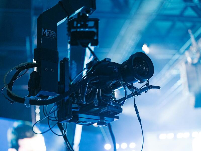
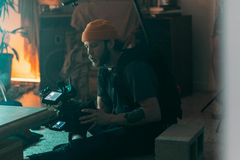
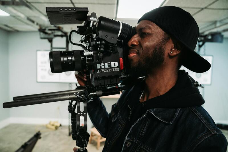
Ensuring the highest quality aerial house photography requires sophisticated equipment and advanced technology. Professionals leverage a combination of specialized drones, high-resolution cameras, and stabilizing gimbals to produce sharp, steady images that highlight the grandeur and unique features of Miami estates.
Modern drones equipped with state-of-the-art stabilization systems not only facilitate smooth flight paths but also allow for precise maneuvering around complex property layouts. This precision is vital for capturing detailed shots of intricate outdoor amenities, gardens, and architectural features situated on sprawling Miami properties.
Camera gear tailored for aerial photography includes mirrorless or DSLR cameras mounted on aerial gimbals. These setups enable capturing crisp, high-resolution images that can be effectively edited for clarity and brightness in post-processing. Such equipment ensures that each shot captures the property's essence with depth and vivid color accuracy, standing out in competitive real estate listings.
Additionally, some professionals integrate thermal or infrared imaging to provide potential buyers with a holistic view of energy efficiency or underlying structural features, adding value to the visual presentation. Deploying the right combination of aircraft, camera equipment, and stabilization technology ultimately results in compelling visuals that serve as powerful marketing assets.
Official Methods for Capturing Aerial Images
When planning aerial house photography, professionals adopt structured and methodical approaches. This involves pre-flight planning, which includes analyzing the property's surroundings, lighting conditions, and the optimal angles to showcase its features. Flight paths are meticulously mapped to avoid obstacles and ensure comprehensive coverage of the property from different vantage points.
Pre-visualization involves selecting the precise time of day to capture images, typically during golden hour, to maximize natural light and enhance visual appeal. The operational process emphasizes safety and adherence to established standards, ensuring imagery is both stunning and compliant with regional guidelines.
Understanding Aerial House Photography
Aerial house photography has revolutionized the way real estate properties are showcased in Miami. By capturing images from elevated viewpoints, professionals can highlight a property's unique architectural features, expansive yards, surrounding landscapes, and accessibility that ground-level photos often miss. This perspective not only enriches the visual appeal but also provides potential buyers with a comprehensive understanding of the property's scale and context within its environment. Aerial visuals are particularly effective in marketing luxury estates, waterfront properties, and large plots of land, where traditional photography may not fully convey the property’s grandeur. The use of drone technology enables smooth, high-resolution captures from various altitudes and angles, offering a dynamic visual narrative that engages viewers instantly. Such imagery can be integrated seamlessly into listing platforms, virtual tours, and promotional videos, amplifying the property's visibility. Moreover, aerial imagery serves as a strategic tool for real estate agents aiming to differentiate their listings in the competitive Miami market. It allows for a storytelling approach, showcasing the property's features such as outdoor amenities, landscaping, and proximity to local attractions. Properly executed aerial photography can significantly accelerate the sales process by attracting more serious inquiries and providing an immersive experience for prospective buyers.
Equipment and Technology Used
The quality of aerial house photography hinges on employing the right equipment and innovative technology. Commercial-grade drones equipped with high-definition cameras are standard, allowing for precise, sharp images with vibrant color accuracy. These drones are often fitted with stabilization gimbals, which ensure smooth footage even in windy conditions or uneven flight paths. Camera systems utilized in aerial photography typically include wide-angle lenses to capture expansive views, alongside telephoto lenses for focused shots of architectural details or landscaping features. Advanced drones also come with GPS-assisted flight capabilities, enabling precise control over flight paths and camera angles. In addition to standard visual captures, many professionals incorporate thermal or infrared imaging, offering insights into energy efficiency and structural integrity of the property. These supplementary imaging techniques can add significant value to marketing efforts by providing potential buyers with comprehensive, multi-dimensional views.
Official Methods for Capturing Aerial Images
To achieve optimal results while maintaining safety and consistency, aerial house photography professionals follow structured protocols for image capture. Pre-flight planning is a critical phase, involving detailed analysis of the property’s environment, including obstacles like trees, power lines, and neighboring structures. This planning ensures safe navigation and unobstructed views. During pre-visualization, photographers select the best times of day—often during the golden hours of early morning or late afternoon—to leverage natural lighting, which enhances the visual richness of aerial shots. Flight paths are carefully mapped out to cover all relevant angles, ensuring comprehensive coverage of the property. Operational procedures emphasize adherence to established safety standards, including maintaining line-of-sight during drone flights, avoiding restricted airspace, and respecting privacy boundaries. These practices not only help in capturing high-quality images but also ensure compliance with local guidelines.
Understanding Aerial House Photography
Aerial house photography offers a unique perspective that captures the full scope of a property and its surroundings, providing potential buyers and investors with invaluable visual insights. This form of imaging highlights not only the stature and layout of the home but also its proximity to key amenities, landscaping features, and neighborhood dynamics. High-resolution aerial images are instrumental in real estate marketing, as they create compelling visual narratives that resonate with viewers and elevate property listings beyond traditional ground-level photos.
By showcasing a property from above, agents can emphasize distinctive architectural elements, natural landscapes, and the overall property footprint, which may be difficult to appreciate from the ground. When executed effectively, aerial photography enhances the property's appeal by illustrating its scale and setting, fostering an emotional connection for prospective buyers and helping them visualize the residence within its environment.
Moreover, aerial photography plays a vital role in establishing credibility and professionalism for real estate agencies and individual sellers. It demonstrates a commitment to quality presentation and thorough market engagement. As part of a comprehensive marketing strategy, aerial images can be integrated into virtual tours, social media campaigns, and online listings, amplifying reach and impact. Ensuring images are captured effectively involves understanding the technical and operational aspects of aerial photography, which hinge upon using the right equipment, understanding environmental considerations, and adhering to established procedures.
Equipment and Technology Used
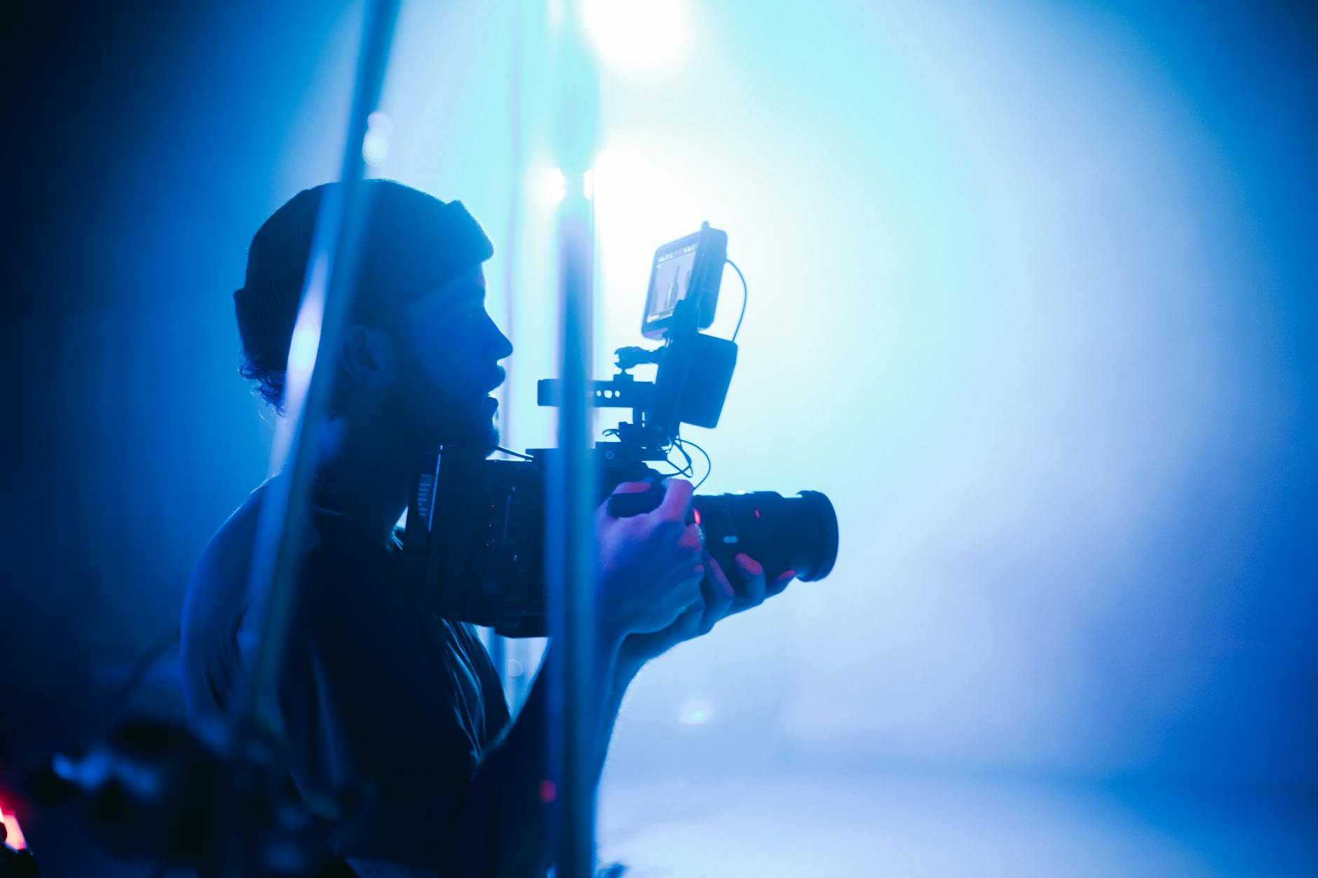
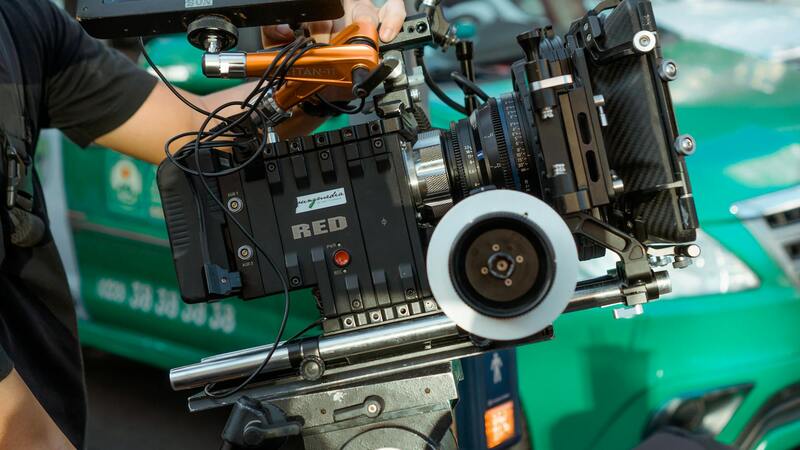
Professional aerial house photography relies heavily on advanced equipment designed to deliver sharp, stable, and precisely framed images. The core technology involves multi-rotor drones equipped with high-resolution cameras, often featuring adjustable lenses for optimal framing and focus. These drones are fitted with stabilized gimbal systems, which mitigate vibrations and movements during flight, resulting in smooth, clear imagery even in windy conditions.
The choice of cameras is critical; many professionals opt for DSLR or mirrorless systems with high megapixel counts, capable of capturing detailed, large-format images suitable for high-quality prints and digital use. Additionally, the integration of remote camera controls allows operators to fine-tune exposure settings, white balance, and focus to adapt to varying lighting conditions.
Beyond drones and cameras, software tools for flight planning are integral to ensure comprehensive coverage of the property. These tools enable operators to plot precise flight paths, set waypoints, and optimize battery life and image overlap. Post-flight, specialized editing software is employed to process raw images, correct color imbalances, enhance details, and stitch images into seamless mosaics when necessary.
Emerging Technologies in Aerial Photography
Innovations such as 4K and 8K video capabilities, thermal imaging, and infrared sensors are expanding the possibilities of aerial imagery. These advancements support applications like 3D modeling, structural inspections, and energy efficiency assessments, further enriching real estate marketing strategies with multi-dimensional visual content.
Advanced Techniques in Aerial House Photography
Employing sophisticated techniques enhances the visual impact and detail of aerial house images, turning standard shots into compelling marketing tools. One such approach is HDR (High Dynamic Range) imaging, which involves capturing multiple exposures and combining them to retain detail in both shadows and highlights. This is particularly useful for capturing properties with complex lighting conditions or reflective surfaces like pools and glass facades.
Needing precise control over exposure and focus, professional aerial photographers often utilize manual settings and pre-planned shot sequences. Flying at optimal angles and altitudes ensures key architectural features are showcased without distortion. For larger properties, grid or panoramic photography enables the creation of comprehensive, high-resolution images that deliver immersive views, providing prospective buyers with a detailed perspective from a single vantage point.
Integrating 3D modeling and photogrammetry techniques, aerial images can be processed into detailed three-dimensional representations of the property. These models facilitate virtual walkthroughs, which are invaluable in the virtual real estate landscape, offering potential buyers an interactive experience that highlights spatial relationships and property features with clarity and precision.
Moreover, multi-spectral imaging, including infrared and thermal sensing, expands the potential of aerial photography. These technologies can reveal underlying infrastructure issues, energy inefficiencies, or landscaping details that are not visible through standard imaging. Such insights are increasingly incorporated into property reports and marketing materials to provide transparency and added value to clients.

By combining these advanced methods with meticulous flight planning and professional editing, aerial house photography evolves into a powerful asset in real estate marketing, delivering stunning visuals that stand out in a competitive market. Each image, thoughtfully captured and processed, communicates quality, attention to detail, and the unique appeal of the property, resonating with prospective buyers and stakeholders alike.
Equipment and Technology Used
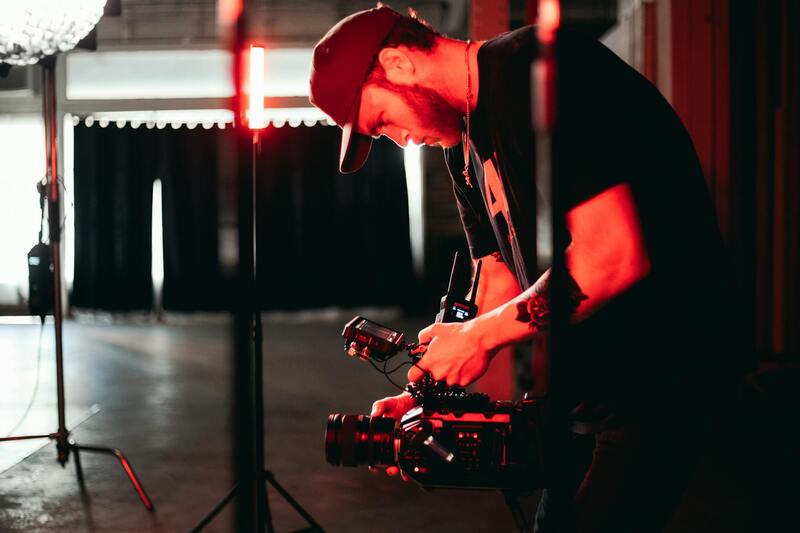
The foundation of high-quality aerial house photography lies in the sophisticated equipment and cutting-edge technology employed by professional photographers. State-of-the-art drones equipped with high-resolution cameras are essential for capturing sharp, detailed images from various angles and elevations. These drones offer stability, maneuverability, and the ability to operate in tight or elevated spaces, making them ideal for residential property shoots.
In addition to drones, professionals often use multi-axis gimbals to stabilize cameras during flight, ensuring smooth footage free from vibrations or jitters. This stabilization hardware is critical for producing polished images that highlight the property's architecture and surroundings effectively.
High-dynamic-range (HDR) imaging capabilities allow photographers to balance exposure across the entire frame, capturing both the bright rooftop areas and shaded yard spaces without loss of detail. This capability results in images that accurately reflect the property’s aesthetic appeal, regardless of lighting conditions.
Furthermore, infrared and thermal sensors integrated into some advanced drones can provide additional perspective, revealing infrastructure issues or energy inefficiencies that are not visible to the naked eye. Such technology enhances the value of aerial visuals by offering comprehensive insights into the property’s condition and energy profile.
Software for flight planning and aerial image processing plays a vital role in the workflow. Mapping software ensures precise control over flight paths, altitude, and camera angles, leading to consistent and repeatable shots. Post-flight, specialized editing tools enhance images further, adjusting brightness, contrast, and saturation, while also stitching panoramic views or creating 3D models for immersive presentations.
In sum, the combination of advanced drone technology, stabilization tools, imaging sensors, and powerful post-processing software ensures that aerial house photography remains a vital asset for real estate professionals looking to showcase properties in Miami with clarity and impact.
Understanding Aerial House Photography
Aerial house photography provides a comprehensive perspective of residential properties, capturing both the expansive layout and intricate architectural details from elevated viewpoints. This approach offers a unique advantage in illustrating the full scope of a property's exterior and surroundings, which can significantly enhance marketing efforts. The technique leverages high-quality drones equipped with advanced cameras, enabling photographers to generate stunning, high-resolution images that highlight the property's best features. In the real estate market, such visuals foster a deeper connection between potential buyers and the property, making listings more memorable and compelling.
The Role of Composition and Perspective
Effective aerial photography hinges on strategic composition. Establishing a balanced perspective ensures that the property's main features, such as the facade, landscaping, and proximity to key amenities, are effectively showcased. Aerial angles can also dramatize certain architectural elements or highlight the property's integration with its surroundings, such as gardens, water features, or neighboring structures. Skilled aerial photographers consider vantage points carefully, selecting heights and angles that maximize visual impact while maintaining clarity and accuracy of the property’s scale.
Understanding Lighting Conditions and Timing
Optimal lighting is crucial for capturing high-quality aerial images. Typically, photographers prefer golden hour—shortly after sunrise or before sunset—when natural light adds warmth and depth, enhancing textures and colors. Overcast days can also provide soft, diffused lighting that minimizes harsh shadows and highlights, producing balanced images suitable for detailed inspection. Timely shoots aligned with weather conditions and natural light conditions ensure that photos are vibrant, well-lit, and professionally appealing.
The importance of flight planning cannot be overstated. Precision in altitude, camera settings, and flight paths ensures consistent results across different shoots. Professionals use sophisticated mapping software to streamline these processes, achieving repeatable results that highlight every aspect of a property's appeal with clarity and precision.
Safety Considerations During Flights
Conducting aerial photography requires adherence to safety protocols. This includes pre-flight inspections, clear communication with relevant parties, and awareness of local airspace restrictions. Aerial photographers prioritize safety to prevent accidents and ensure smooth operation, especially in densely populated or sensitive areas where drone operations must be carefully managed.
Enhancing Listings with 3D and Panoramic Views
Beyond standard photographs, advanced techniques such as 3D modeling and panoramic stitching add value to real estate presentations. These methods allow potential buyers to virtually explore a property, gaining a comprehensive understanding of its layout and environment remotely. Such immersive visuals are increasingly becoming a standard part of high-end real estate marketing strategies, helping listings stand out in competitive markets.
Overall, aerial house photography combines technical precision with artistic insight, creating engaging visuals that tell the story of a property from a unique vantage point. Mastery of the equipment, understanding of optimal conditions, and strategic composition collectively contribute to compelling imagery that resonates with buyers and enhances marketing success.
Understanding Aerial House Photography
Aerial house photography offers a dynamic perspective that captures the full scope of a residential property, highlighting both its design and surroundings from an elevated vantage point. This approach not only enhances visual appeal but also provides potential buyers with comprehensive context about the property's layout, proximity to amenities, and neighborhood features. By incorporating aerial shots into marketing materials, real estate brokers can create a compelling narrative that differentiates listings in competitive markets.
Equipment and Technology Used
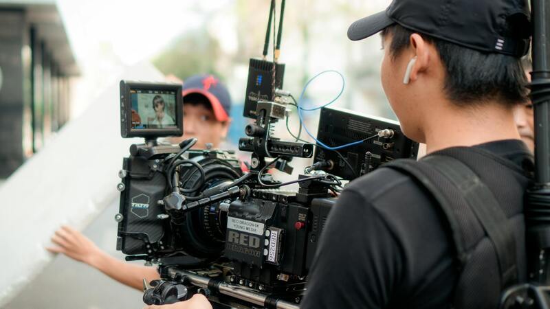
Modern aerial house photography relies heavily on advanced equipment that ensures high-quality results. Key tools include drones equipped with high-resolution cameras capable of capturing detailed images at multiple angles. These drones often feature stabilized gimbals to prevent motion blur and ensure smooth, sharp footage. Complementing drone technology are software solutions for flight planning and image stitching, which facilitate precise navigation and panoramic or 3D image creation. The integration of GPS and obstacle avoidance systems enhances safety and operational efficiency, enabling photographers to execute complex shots with confidence.
Regulations and Permits in Miami
In Miami, conducting aerial house photography involves navigating specific regulatory frameworks that govern drone operations. Ensuring compliance with local airspace rules is essential for a smooth filming process. Typically, professionals obtain necessary permissions from relevant authorities and adhere to designated flight zones and altitude limits. Weather conditions, no-fly zones around sensitive areas, and privacy considerations also shape how aerial photography projects are planned and executed. Working with experienced operators familiar with Miami’s regulations can streamline permissions and reduce potential delays.
Best Practices for Shooting Residential Properties
Effective aerial house photography hinges on strategic planning and execution. Photographers should conduct thorough site surveys to identify optimal angles and lighting conditions, aiming for times when natural light enhances the property’s features. Flight paths are carefully planned to encompass the entire property and surroundings, capturing both the home’s architectural details and its landscape. Post-flight, images are checked for clarity and composition, with retakes scheduled if necessary. The goal is to produce a cohesive visual story that highlights the property's value and unique selling points.
Editing and Post-Processing of Aerial Images
Post-processing plays a critical role in elevating raw aerial footage into polished promotional materials. Image enhancement techniques include adjusting brightness, contrast, and color balance to accurately represent the property’s appearance. Perspective correction ensures buildings and landscapes appear proportionate, while selective sharpening accentuates architectural details. Stitching multiple images into panoramic views or creating 3D models involves software that aligns overlapping photos precisely. The final images are optimized for various marketing platforms to ensure they load quickly without sacrificing quality. This meticulous editing process results in compelling visuals that resonate with prospective buyers.
Benefits of Aerial House Photography for Real Estate Marketing
The incorporation of aerial imagery significantly boosts the visibility and appeal of residential listings. From a marketing standpoint, these images foster an emotional connection by showcasing a property’s grandeur and setting. Potential buyers can gain a comprehensive understanding of spatial relationships and property features that might be less apparent from ground-level photos. This not only accelerates decision-making but also reduces the number of unnecessary viewings. Additionally, aerial photographs can be integrated into virtual tours, social media campaigns, and print advertisements, multiplying the reach and impact of marketing efforts.
Visual Impact and Buyer Engagement
High-quality aerial photos create an immediate visual impact, drawing attention to listings in crowded online portals or print brochures. By presenting a property's full extent and nearby amenities from above, agents can generate heightened interest and encourage more scheduled viewings. Drone photography also lends a modern, innovative image to real estate branding, aligning with contemporary aesthetic preferences and technological trends.
Enhanced Listing Credibility
Including professional aerial images signals a commitment to quality and transparency, fostering trust among potential buyers. Such visuals demonstrate thorough marketing efforts and provide assurance that all aspects of the property have been showcased accurately. This level of presentation often results in quicker sales cycles and higher sale prices compared to listings without aerial imagery.
Selecting a Miami Production Agency for Aerial Photography
Choosing an experienced production partner is crucial for achieving top-tier aerial visuals that meet professional standards. A reputable Miami-based agency will have a portfolio of successful projects, knowledgeable operators familiar with local terrain and airspace constraints, and a comprehensive understanding of the latest imaging technology. They will also handle all necessary permits and ensure safety protocols are rigorously followed. Engaging seasoned experts guarantees that the aerial shots are strategically composed, technically flawless, and aligned with your marketing objectives.