Introduction to Aerial Real Estate
In the highly competitive Miami property market, aerial real estate has emerged as an essential tool for showcasing properties from unique perspectives. Utilizing elevated viewpoints allows real estate professionals and property owners to highlight the true scope and grandeur of a property, offering potential buyers a comprehensive visual experience that traditional ground-level photography cannot provide. Aerial imagery captures the full extent of sprawling estates, waterfront properties, and intricate landscapes, enabling a more compelling presentation.
Effective aerial photography enhances marketing strategies by providing high-quality visuals that stand out in listings and promotional materials. It facilitates better property valuation through detailed visualization of land contours, property boundaries, and surrounding amenities. These high-resolution visuals can reveal features like land size, proximity to key infrastructure, and natural surroundings—crucial elements for prospective investors and buyers.
The integration of aerial footage into real estate marketing has become a game-changer in Miami, where the real estate landscape is characterized by both opulence and diverse landscapes. Leveraging advanced aerial imaging techniques enhances the appeal of listings and enables real estate agents to communicate the full potential of a property more effectively.

By adopting aerial real estate visuals, stakeholders can achieve a competitive edge, attract more interested buyers, and facilitate quicker sales. As Miami continues to evolve as a hub of luxury real estate and innovative marketing, the role of aerial imagery becomes increasingly important in setting properties apart from the crowd.
Legal and Regulatory Considerations in Miami
When capturing aerial real estate footage in Miami, understanding the framework of authorized methods is essential for ensuring smooth operations and providing high-quality visuals legally and responsibly. Miami’s airspace is regulated to balance the interests of commercial, recreational, and governmental entities, requiring practitioners to adhere to established guidelines.
Operators must utilize dedicated aircraft or drones that meet specified standards for weight, payload, and operational capabilities, often mandated by local authorities. These standards are designed to guarantee safety, privacy, and compliance with airspace management protocols.
Securing the appropriate permits is a critical aspect of legal aerial operations in Miami. This process typically involves submitting a detailed flight plan outlining the purpose, location, altitude limits, and flight duration. It is also necessary to coordinate with local authorities, such as the Miami-Dade Aviation Department, to receive clearance before drone deployment or aircraft flight.
Operational restrictions often include altitude limits, no-fly zones around sensitive infrastructure such as airports, governmental buildings, and private properties, as well as restrictions during certain times of day or in adverse weather conditions. Compliance with these regulations ensures that flights do not interfere with manned aircraft or infringe on individual privacy rights.
In Miami, data protection laws emphasize respectful usage of aerial footage, especially when capturing private properties. Operators are advised to obtain consent from property owners when required and to avoid capturing images that could compromise personal privacy or security.
Professional aerial service providers in Miami often work with certified pilots who are knowledgeable about the local airspace regulations, enabling them to execute projects efficiently and within legal parameters. These experts leverage advanced planning tools and real-time airspace monitoring to prevent unauthorized operations, thereby safeguarding all parties involved.
Enhancing Aerial Real Estate Marketing Strategies
In the competitive Miami real estate market, leveraging aerial imagery has become a key differentiator for property listings. High-quality aerial photography and videography not only attract potential buyers but also provide a comprehensive view of the property’s surroundings, such as nearby amenities, landscape features, and neighborhood attractions. Real estate professionals and developers recognize that integrating aerial visuals into marketing campaigns can significantly increase engagement and accelerate sales timelines.
Effective integration of aerial footage involves strategic placement within digital and print marketing channels. Virtual tours enhanced with drone footage allow prospective buyers to explore properties remotely, gaining a better understanding of spatial relationships and property scale. Additionally, aerial images are ideal for use in online listings, social media campaigns, and promotional videos, making properties stand out in a crowded marketplace.

Incorporating aerial content requires a structured approach to ensure the visuals are both compelling and compliant with local standards. Collaborating with certified aerial imaging providers ensures that the projects meet professional quality standards while adhering to the relevant regulations. These providers utilize advanced camera stabilization technology and flight planning tools that enable capturing clear, dynamic footage at various angles and altitudes.
Beyond traditional real estate marketing, aerial imagery supports project development and site analysis. Developers use drone footage for site planning, showcasing new constructions or renovations from an overhead perspective. This comprehensive visualization aids in decision-making, permitting processes, and attracting investment opportunities.
Creating a consistent visual branding strategy through aerial content can bolster an agency’s reputation, facilitating recognition among clients and within the Miami real estate community. When executed expertly, aerial imagery becomes an invaluable asset, providing a competitive edge and a richer storytelling medium for property presentations.

In conclusion, the strategic use of aerial imagery in real estate elevates marketing efforts, boosts property visibility, and enhances client engagement. As technology advances and the demand for high-quality visuals grows, partnering with experienced aerial service providers in Miami ensures that your property campaigns remain innovative, impactful, and compliant with local standards.
Applications of Aerial Real Estate Footage
Utilizing aerial real estate footage offers a multitude of applications that significantly enhance the marketing and development processes. High-quality aerial visuals serve as compelling tools for property listings, enabling potential buyers to obtain a panoramic view of the property and its surroundings. These visuals can highlight key features, such as expansive land parcels, waterfront access, or landscaped gardens, that might be less noticeable in ground-level photos.
Real estate agents frequently incorporate aerial imagery into their marketing campaigns to create immersive virtual tours. These tours let prospective buyers explore property layouts and contextual surroundings from the comfort of their homes. Additionally, for commercial properties, aerial footage aids in showcasing proximity to infrastructure, transportation links, and commercial hubs, which are crucial factors in buyer decision-making.

Beyond individual property promotion, aerial real estate footage is instrumental in project visualization for developers and investors. It offers a comprehensive overview of site conditions, enabling stakeholders to assess spatial relationships and environmental integration more effectively. This visualization perspective streamlines planning processes and improves communication among teams.
Furthermore, aerial footage can document the progress of construction projects over time, providing valuable insights into development stages. Such documentation enhances transparency for investors and regulatory bodies, ensuring developments are systematically monitored.
For marketing agencies, aerial visual content also possesses the capability to craft storytelling narratives that resonate with targeted audiences. By combining dynamic shots, panoramas, and detailed flyovers, agencies can establish a unique brand identity that stands out in competitive markets.
Advantages of Incorporating Aerial Footage in Miami’s Real Estate Scene
- Showcase unique Miami landscapes and waterfront properties from a perspective that emphasizes location desirability.
- Attract international buyers with visually immersive campaigns highlighting Miami’s vibrant neighborhoods and luxury estates.
- Support property development projects with detailed site analysis and promotional visuals that appeal to investors and stakeholders alike.
- Enhance virtual open houses with breathtaking aerial views that stimulate interest and engagement among remote viewers.
- Document environmental features such as green spaces and water bodies, which are often critical selling points in Miami.
Legal and Regulatory Considerations in Miami
Navigating the official channels for aerial operations is essential for maintaining a seamless workflow and ensuring compliance with local standards. In Miami, operators involved in capturing aerial real estate footage must adhere to the guidelines set forth by aviation authorities and municipal regulations, which govern drone flight permissions, restricted zones, and operational times. Securing proper authorization typically involves submitting detailed flight plans that delineate the scope of the project, including the locations, altitudes, and durations of flights.
Establishing clear communication with relevant agencies can facilitate smoother approval processes, especially for shoots over densely populated or sensitive areas. It is important to identify and respect areas that may have flight restrictions, such as near airports, government buildings, or private properties, to prevent disruptions and promote safety. Engaging with local authorities ahead of scheduled shoots ensures that all operational parameters are aligned with official expectations, reducing any potential setbacks.
Joint efforts with local regulatory bodies also involve aligning flight activities with designated no-fly zones and current airspace regulations. Regularly monitoring updates from the Federal Aviation Administration (FAA) and Miami-specific agencies helps operators stay informed of any changes that could impact ongoing or future projects.
Furthermore, maintaining thorough records of flight logs, permits, and correspondence with authorities can streamline the process for renewing permissions and demonstrating compliance. This proactive approach not only safeguards against potential legal issues but also enhances the credibility of the production team. Professionals involved in aerial real estate projects often collaborate with well-versed pilots and licensed drone operators who are experienced in navigating Miami's specific regulatory environment, ensuring that each shoot adheres to established standards without compromising safety or quality.

By prioritizing official procedures, real estate professionals and production houses can effectively leverage aerial footage to showcase Miami’s vibrant properties while respecting operational guidelines. This disciplined approach ensures that promotional efforts are sustainable, legally compliant, and aligned with the city’s commitment to safety and environmental preservation.
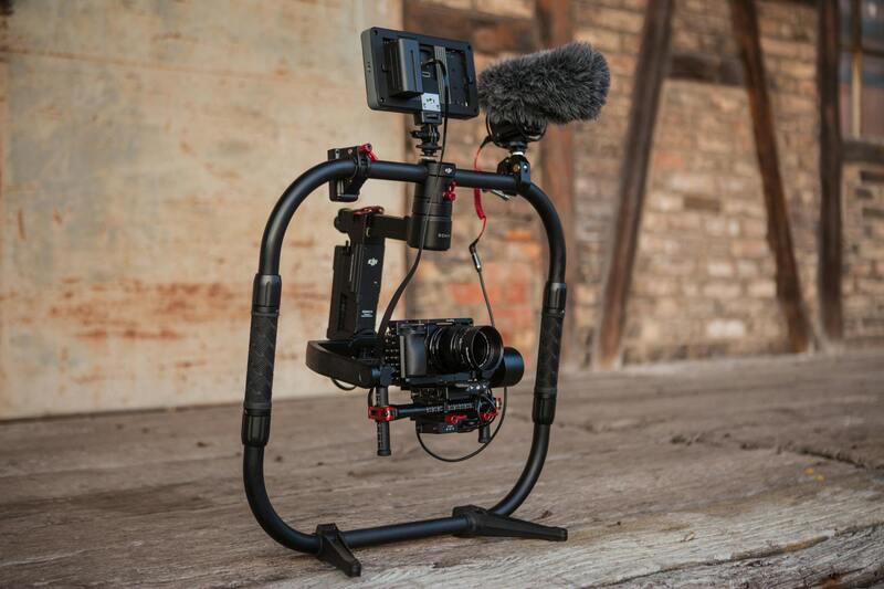
Examples of Certified Drone Operators and Approved Equipment in Miami
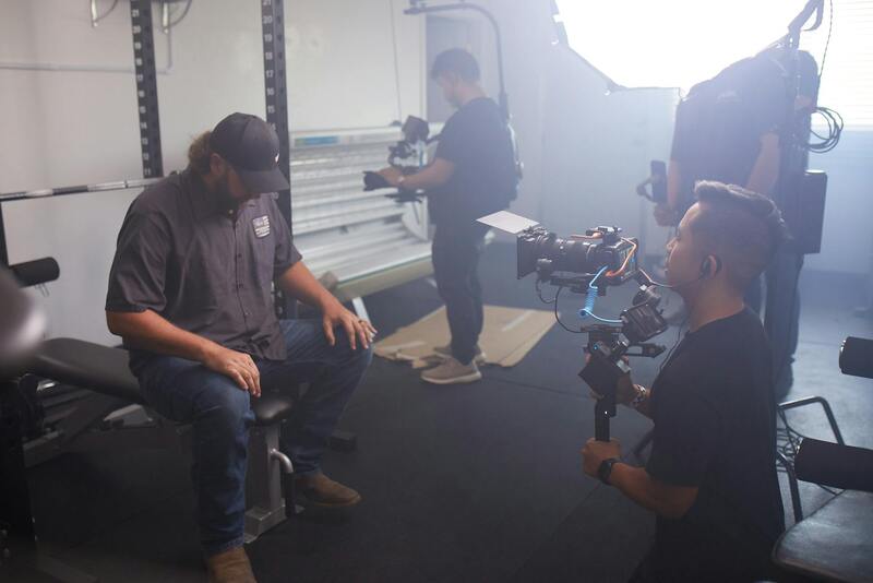
Utilizing aerial real estate footage in Miami requires engagement with certified drone operators who adhere to established operational standards and training protocols. These professionals often hold industry-recognized certifications and are well-versed in local airspace management, ensuring their flights are conducted safely and efficiently. Choosing operators with proven experience in real estate photography guarantees that the captured imagery meets high production values and aligns with marketing objectives.
In terms of equipment, established operators deploy a range of approved drones equipped with high-resolution cameras capable of capturing detailed images and smooth video footage from various altitudes. These drones are maintained according to manufacturer specifications and undergo regular inspections to ensure optimal performance. Advanced stabilization systems, long-range communication links, and obstacle avoidance technology are integral to the equipment, facilitating smooth, stable shots even in complex urban environments.
Furthermore, operators often incorporate specialized accessories such as polarizing filters and variable ND filters, which help optimize image quality under Miami's variable lighting conditions. The combination of certified pilots and state-of-the-art equipment creates a seamless workflow from planning and permits to execution and post-production.

Legal and Regulatory Considerations in Miami
In Miami, conducting aerial real estate imaging requires adherence to specific operational standards that ensure safety, privacy, and proper management of airspace. To capture high-quality aerial footage responsibly, professionals must utilize methods that align with established guidelines and secure the necessary approvals from relevant authorities.
One of the key components is obtaining the appropriate flight authorizations, which involve submitting detailed flight plans that specify the intended areas of operation, altitude restrictions, and times of operation. These documents typically include information about the drone's technical capabilities, safety procedures, and how the footage will be used to ensure that all activities are conducted within approved parameters.
Operators often rely on official maps and established airspace classifications to determine where drone flights are permissible. This includes avoiding restricted zones such as airports, military bases, and other sensitive areas, thereby minimizing potential conflicts with manned aircraft and safeguarding public safety.

Proper pre-flight planning encompasses checking weather conditions, ensuring all equipment is compliant with safety standards, and confirming that the team has the necessary permits for each project. Using up-to-date technology for real-time altitude and location monitoring further helps maintain compliance and operational accuracy.
Maintaining clear documentation of all permits and approvals is essential, as it demonstrates a commitment to responsible flying practices and provides a record that can be referenced in case of inquiries or audits. Certified drone pilots often participate in ongoing training to stay current on evolving regulations and best practices, which significantly contributes to the professionalism of aerial real estate operations.

Collaborating with experienced and authorized aerial operators facilitates the seamless integration of aerial footage into real estate marketing. This partnership not only ensures compliance but also enhances the quality and impact of visual content, ultimately driving greater interest and engagement for property listings in Miami's competitive market.
Applications of Aerial Real Estate Footage
High-quality aerial footage plays a pivotal role in the marketing strategy for real estate professionals aiming to showcase their properties in Miami's vibrant market. This unique perspective provides potential buyers with a comprehensive view of a property’s layout, surrounding neighborhood, and proximity to key amenities such as beaches, parks, and transportation hubs. By capturing extensive and detailed visuals, agents and developers can highlight the full scope of a property’s features and its context within the larger community, making listings more compelling.
Beyond traditional marketing, aerial footage is instrumental in creating engaging virtual tours and immersive viewing experiences. This method allows prospective buyers to virtually explore property exteriors and landscapes from multiple angles, fostering a deeper connection and understanding of the property’s appeal. Additionally, aerial imagery can be integrated into digital advertisements, social media campaigns, and website galleries, increasing visibility and attracting a broader audience during the property’s promotional cycle.
In real estate development and project management, aerial footage serves as an efficient documentation tool. It provides clear records of construction progress, site conditions, and compliance with planning regulations. This visual documentation supports decision-making processes and enhances transparency with stakeholders and investors.

Furthermore, aerial videos are powerful for showcasing community features and lifestyle attractions that may influence buyer interest. Footage of nearby beaches, recreational areas, and local amenities can effectively communicate the appeal of a neighborhood environment, helping clients visualize their potential new lifestyle. This strategic use of aerial imagery often results in quicker sales cycles and higher property valuation, especially in competitive markets where standing out is crucial.
Enhancing Commercial and Luxury Property Listings
For luxury estates and commercial developments, aerial images and videos transmit a sense of scale, prestige, and exclusivity. They allow viewers to appreciate expansive landscapes, elaborate architectural designs, and luxurious amenities in a single, captivating view. Accurate and high-quality aerial footage can elevate branding and marketing efforts, making listings more attractive to discerning buyers and investors globally.
Utilizing Aerial Data for Market Analysis
Accurate aerial mapping also supports market analysis and strategic planning. Real estate firms can leverage this data to evaluate land use patterns, assess development potentials, and identify emerging areas within Miami. This information enables data-driven decisions, ensuring investments align with market trends and urban growth trajectories.

As Miami continues to attract real estate investments, aerial footage remains an indispensable asset. Properly captured and utilized, aerial imagery not only amplifies marketing efforts but also supports transparent reporting and strategic development, solidifying its role as a vital element in the contemporary real estate landscape.