Introduction to Aerial Real Estate Photography
In the highly competitive housing market of Miami, showcasing properties through stunning visuals has become an essential part of effective marketing. Aerial real estate photography has emerged as a powerful tool that provides prospective buyers with a comprehensive view of a property and its surroundings. This specialized form of photography captures images and videos from elevated angles, offering unique perspectives that traditional ground-level shots cannot achieve.
By utilizing drones and other advanced imaging technologies, real estate professionals are now able to highlight the full scope of residential and commercial properties. For Miami's vibrant real estate scene, characterized by waterfront estates, sprawling urban developments, and luxury high-rises, aerial images deliver a compelling visual narrative that can significantly influence buyer interest. The integration of aerial photography into real estate marketing strategies not only enhances the attractiveness of listings but also provides a competitive edge in a bustling market.
The increasing accessibility of drone technology and the rising demand for visually immersive listings have cemented aerial photography as a fundamental component of real estate promotion in Miami. When executed professionally, these images can effectively communicate the scale, location advantages, and architectural features of a property, helping potential buyers visualize themselves living or working in the space. Consequently, real estate agents and marketers who leverage these capabilities tend to see improved engagement, faster sales, and elevated market presence.
Equipment and Technology Used in Aerial Photography
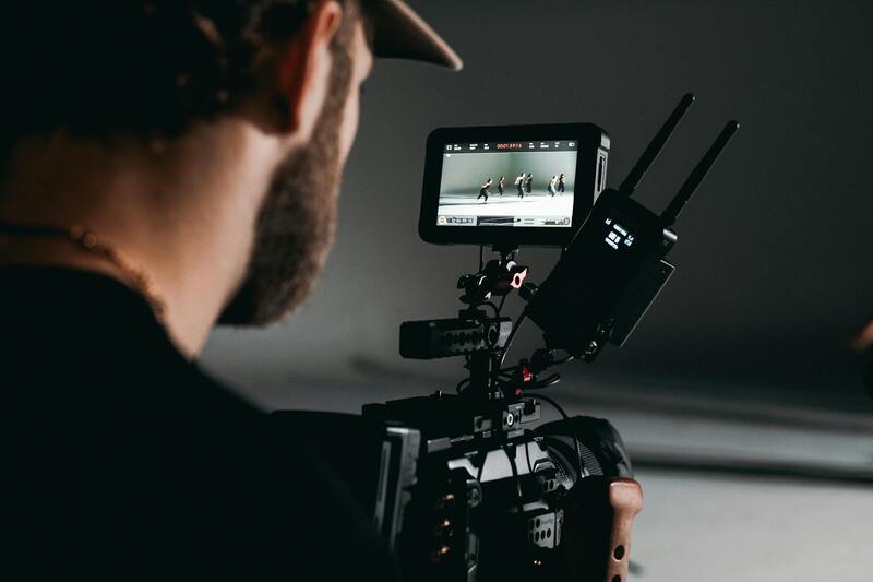
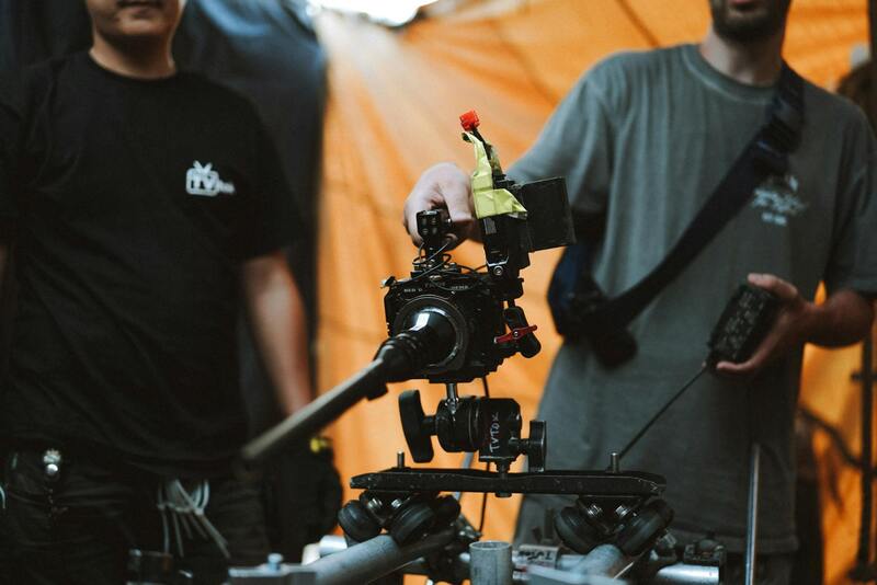
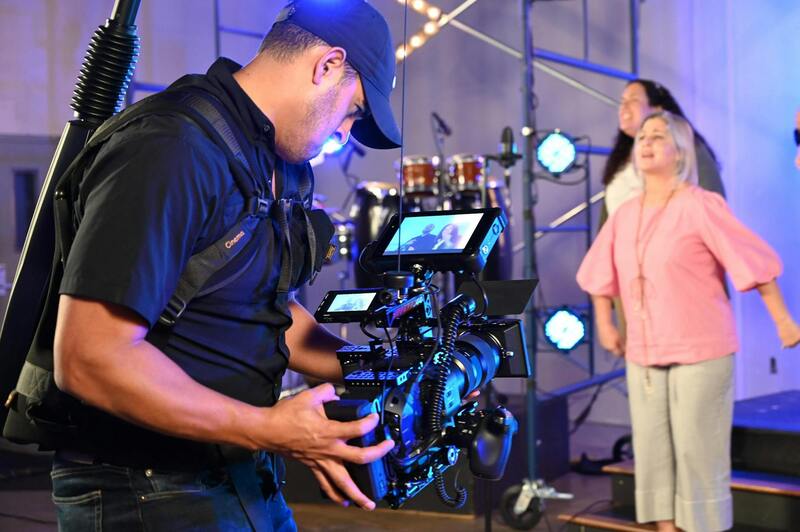
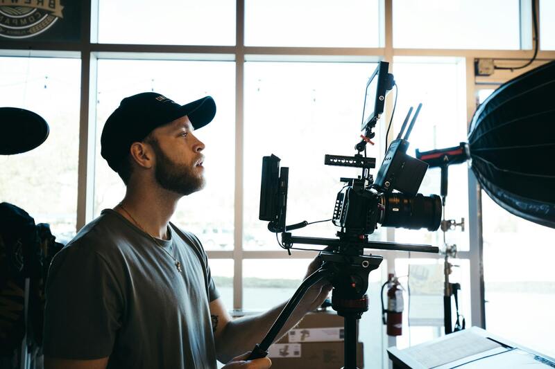
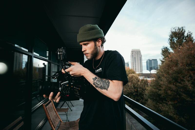
Implementing high-quality aerial real estate photography requires advanced equipment that ensures both safety and image excellence. The core tools include sophisticated drones equipped with HD or 4K cameras capable of capturing sharp, high-resolution images from various heights and angles. These drones often feature stabilization technology, such as gimbals, to maintain steady footage even in windy conditions, resulting in clear visuals that accurately represent the property.
Beyond drones, professionals utilize various accessories to optimize the quality of their shots. This includes wide-angle lenses to encompass more of the property in a single frame, filters to manage lighting and glare, and high-capacity batteries to extend flight times for comprehensive coverage. Additionally, specialized controllers with live feed capabilities allow operators to monitor images in real-time, ensuring precise framing and focus.
Emerging technologies are also playing a vital role. For instance, automated flight planning software enables precise control over flight paths, maximizing efficiency and safety. Some high-end systems incorporate obstacle avoidance sensors, reducing the risk of collisions and ensuring smooth operation around complex environments.
Ensuring Authentic Routes and Methodologies in Aerial Imagery
Producers of aerial real estate photography prioritize legitimate approaches to capture superior visuals. This multi-step process is rooted in adherence to established regulations and the utilization of trusted techniques that guarantee both push-button efficiency and visual excellence. Such methods involve meticulous route planning, comprehensive site assessments, and the deployment of sophisticated equipment operated by certified professionals.
Before any flight, a detailed flight plan is developed to define the optimal path over a property. This plan accounts for various factors such as property size, surroundings, lighting conditions, and potential obstacles. Using advanced software, operators can map out precise routes that maximize coverage while avoiding hazards. This approach ensures that every shot delivers comprehensive, captivating perspectives that highlight the property's best features.
In addition to route planning, official drone operation procedures emphasize thorough site reconnaissance. This includes identifying potential interference sources, adjusting for environmental conditions like wind and light, and ensuring the operational area has unobstructed access. Certified operators carefully inspect the property perimeter and setting to determine the best vantage points for capturing compelling imagery.

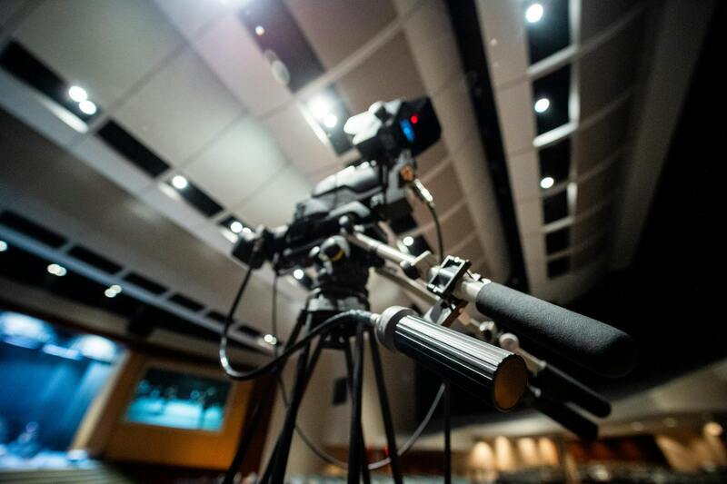
High-caliber equipment is deployed to achieve professional results. This involves high-resolution cameras with adjustable lens systems, stabilization mechanisms like gimbals, and flight controllers equipped with real-time telemetry. The integration of these tools allows operators to maintain optimal image sharpness, correct exposure, and stable framing throughout the flight.
Employing proven operational procedures and commercially available, authorized technology ensures the visual material generated is both impressive and reliable. Such practices maintain a consistent quality standard for marketing materials, enabling real estate listings to stand out amidst competitive markets. Moreover, utilizing these official methods fosters trust with clients, who can be assured that the imagery reflects an accurate and appealing portrayal of the property.
Safety protocols, including pre-flight checks, flight zone clearances, and operator certifications, form the backbone of credible aerial real estate photography. These measures guarantee that each operation adheres to stringent standards, thereby minimizing risks and producing high-quality images that effectively showcase properties.
Best Practices for Aerial Photography in Real Estate
Implementing effective aerial photography techniques is essential for producing captivating images that highlight the unique features of each property. These practices encompass several key elements that ensure high-quality results while adhering to industry standards and best practices.
- Optimal Flight Altitudes: Flying at appropriate heights allows for capturing both expansive property layouts and detailed exterior features. Typically, flights are conducted at heights between 50 to 150 feet, balancing broad coverage with image clarity. Adjustments are made based on property size, location, and desired visual impact.
- Lighting Conditions: The timing of the shoot significantly influences image quality. Clear, sunny days with minimal wind are ideal for optimal lighting, which enhances colors and shadows. Early mornings and late afternoons often provide the most flattering natural light, reducing harsh shadows and glare.
- Camera Settings: Utilizing high-resolution cameras with adjustable aperture, shutter speed, and ISO settings ensures crisp images. Proper exposure compensation and white balance adjustments are crucial for accurate color reproduction and detail retention.
- Shot Composition: Paying attention to framing, perspective, and focal points results in visually appealing images. Incorporating wide-angle shots alongside close-up vantage points captures the property's full scope while highlighting distinctive architectural details.
- Safety and Compliance: Conducting pre-flight assessments to identify potential obstacles, such as power lines or nearby structures, ensures safe operation. Maintaining clear flight zones and respecting no-fly areas preserve safety and compliance standards.
Lighting Considerations for Aerial Imaging
Lighting plays a vital role in determining the visual appeal of aerial real estate photography. Optimal images are captured under conditions that provide balanced illumination and depth. Overcast days can offer diffuse lighting, reducing shadows and glare, which can be beneficial in certain scenarios. Conversely, bright, clear days with low wind conditions typically produce crisp, vibrant images.
Strategic planning around the sun's position ensures shadows fall favorably, emphasizing architectural lines and landscaping. Additionally, adjusting camera settings to accommodate changing light conditions helps maintain consistency across the shoot.
Legal and Regulatory Considerations in Miami
Obtaining appropriate permissions for aerial photography in Miami involves following established protocols that respect property rights and airspace management. Professionals coordinate with local authorities and property owners to gain necessary clearances, ensuring operations are conducted within designated guidelines. Using authorized flight paths and adhering to height restrictions help optimize safety and image quality.
Clear communication with relevant agencies aids in scheduling shoots and preventing disruptions. Maintaining detailed documentation of flight plans, permissions, and operator certifications reinforces compliance and fosters trust with clients and local communities.
Official Methods for Capturing Aerial Real Estate Photography
Executing aerial real estate photography through authorized channels involves adhering to structured procedures that prioritize safety, professionalism, and adherence to established standards. Certified drone operators and licensed piloting professionals typically acquire specific permits for each project. These permits are obtained through formal applications submitted to relevant local aviation authorities, which require detailed flight plans outlining the intended flight altitude, timeframes, and geographic boundaries. Such processes ensure that aerial operations are coordinated responsibly within the designated airspace, minimizing disruptions to other airspace users and surrounding communities.
Once permissions are secured, operators utilize a combination of advanced equipment and software to plan their flight paths meticulously. Flight planning tools allow for precise navigation, altitude setting, and obstacle avoidance, ensuring the drone captures high-quality images without infringing on private properties or restricted zones. Prior to the shoot, a comprehensive site survey is conducted—identifying vantage points, optimal angles, lighting conditions, and potential hazards. This pre-flight evaluation is integral to achieving consistent, professional results that enhance property visibility and appeal.
During the actual photography session, operators adhere strictly to the approved flight plan, maintaining communication with relevant authorities or property owners as needed. Continuous monitoring guarantees the drone operates within prescribed altitudes and areas, preventing accidental intrusions into restricted zones or private spaces. Additionally, professional-grade equipment with stabilized gimbals and high-resolution cameras is employed to produce sharp, detailed images that accurately represent the property's features from impactful perspectives.
Utilizing Certified Equipment and Technology
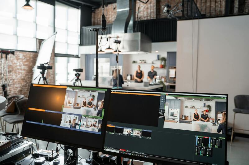
Modern aerial real estate photography relies on sophisticated drones equipped with high-resolution cameras, GPS stabilization, and obstacle avoidance systems. These technologies facilitate safe and efficient operation, enabling consistent image quality even in challenging weather conditions or complex layouts. Using drones with certified components assures the reliability of flight data and imaging outputs, which is crucial for creating compelling marketing visuals. Moreover, integrating real-time flight data and imagery with ground-based inspection tools streamlines the workflow between aerial capture and post-processing stages, maintaining a seamless quality assurance process.
Ultimately, prioritized safety protocols, thorough planning, and adherence to official procedures combine to produce aerial real estate images that are both visually striking and compliant with professional standards. This careful approach ensures the images serve as powerful tools in marketing campaigns, attracting potential buyers and showcasing properties in the most advantageous light.
Official Certification and Training for Aerial Photography Operators
To maintain consistency, safety, and professionalism, operators engaged in aerial real estate photography often pursue official certification programs. These programs typically encompass comprehensive training in drone operation, safety protocols, privacy considerations, and photography techniques. Certification not only validates an operator’s skills but also demonstrates a commitment to following established standards, which is essential for delivering high-quality imagery that aligns with industry expectations.
In regions like Miami, specialized courses offered by accredited institutions or industry associations guide operators through complex regulations, ensuring they are equipped with the latest knowledge on operational best practices. These courses cover essential topics such as airspace management, emergency procedures, and equipment maintenance, which collectively contribute to the consistent delivery of professional-grade aerial images.
Adherence to Airspace and Flight Path Regulations
Efficient aerial real estate photography is contingent upon strict adherence to designated airspace rules. This involves careful planning of flight paths to avoid restricted zones, such as near airports or military installations, and to minimize disturbance to residents. Prior to each shoot, operators consult official airspace maps and use FAA or local authority resources to identify no-fly zones and altitude limitations.
Utilizing official notices and permissions ensures that flight plans are compliant, which is vital for maintaining an ethical and professional approach. Furthermore, leveraging official digital tools, such as flight planning applications and geofencing technology, helps operators adhere to boundaries and avoid accidental incursions into sensitive areas.
Insurance and Liability Coverage
Engaging in aerial real estate photography also involves securing appropriate insurance coverage. This not only protects the operator from potential liabilities but also reassures clients of the professionalism and accountability of the service provider. Insurance policies typically cover equipment damage, personal injury, and potential property damage caused during flight operations.
Having comprehensive coverage in place aligns with industry standards and demonstrates a responsible approach to aerial operations. By aligning with these certified procedures, operators uphold a high level of trustworthiness needed to perform legitimate aerial real estate photography at the highest operational standards.
Incorporating these official methods and standards within aerial real estate photography practices not only enhances image quality and safety but also helps build a reputable brand that clients can depend on for professional marketing solutions. Proper certification, knowledge of airspace regulations, and appropriate liability coverage are foundational pillars that support a compliant, effective, and visually compelling aerial portfolio for real estate listings.
Ensuring Proper Operational Procedures in Aerial Real Estate Photography
Executing aerial real estate photography responsibly involves meticulous planning and adherence to established procedures that safeguard the interests of clients, property owners, and neighboring communities. Certified flight plans are essential for preventing unauthorized incursions into restricted zones and maintaining optimal flight paths. Utilizing official digital platforms for flight planning helps ensure compliance with airspace management protocols, enhances safety, and minimizes the risk of accidents.
One critical aspect of adhering to standard procedures is comprehensive pre-flight assessments. This includes reviewing weather conditions, verifying equipment functionality, and confirming that all permissions and notifications are in place before launching any aerial operation. Proper coordination with local authorities and property managers further safeguards against misunderstandings and potential disruptions.
During flight execution, operators must maintain constant communication, employ approved flight paths, and ensure that flights remain within designated boundaries. Real-time monitoring of the drone's position through certified applications reduces the risk of mishaps and confirms that the imagery collection aligns with project specifications. Post-flight procedures include data validation, secure handling of footage, and comprehensive documentation of flight details to facilitate transparency and accountability.
Utilizing Certified Equipment and Technology
Using industry-approved drones and professional-grade cameras ensures that imagery capabilities meet the rigorous standards required for high-quality real estate marketing. Certified UAVs equipped with GPS stabilization, obstacle avoidance sensors, and high-resolution cameras enable operators to achieve precise, clear, and visually appealing images. Integration of advanced aerial mapping tools and software also allows for detailed property analysis and virtual walkthroughs.

Regular maintenance and calibration of equipment, along with ongoing training for operators, uphold the highest standards in aerial photography. Certification programs and adherence to industry best practices foster professionalism, instill confidence among clients, and uphold the reputation of service providers.
Implementing a Quality Control Process
Effective quality control procedures involve multiple stages, starting from pre-flight checks to post-processing reviews. Establishing checklists for each phase guarantees consistency and completeness, reduces errors, and enhances overall image quality. Post-flight data review allows for the correction of any deficiencies and ensures that the final deliverables meet project specifications.
Maintaining detailed logs of each flight, including operational parameters, environmental conditions, and equipment performance, supports continuous improvement and accountability. Utilizing secure data storage and backup solutions ensures the integrity and availability of raw footage and final images for client review and archiving.
Documentation and Compliance Reporting
Proper documentation is a cornerstone of professional aerial photography practices. This includes comprehensive records of flight permissions, safety checks, equipment calibration, and incident reports, when applicable. Accurate reporting not only demonstrates compliance with operational standards but also provides transparency for clients and regulatory authorities.
Developing standardized templates and digital forms streamlines the documentation process and ensures consistency across projects. Clear and accessible records foster trust, facilitate audits, and support ongoing certification and quality assurance efforts.
Legal and Regulatory Considerations in Miami
For professionals engaged in aerial real estate photography within the Miami area, adhering to established procedures and obtaining requisite permissions is an essential component of operational excellence. While operating high-quality drones or UAVs, practitioners must navigate a framework that emphasizes safety, privacy, and responsible usage. This involves securing the appropriate operational authorizations, which typically include flight permits issued by relevant municipal or state authorities, and ensuring compliance with airspace regulations governed by national agencies. These permissions are often contingent on detailed flight plans, including altitude restrictions, designated no-fly zones, and the times at which flights are permissible to minimize disruption and enhance safety.

Utilizing pre-flight checklists not only ensures all equipment is operational and calibrated but also aligns with the procedural precepts required for legal operation. Maintaining thorough documentation—such as flight logs, permission records, and safety assessments—provides a transparent trail that supports accountability and demonstrates adherence to industry standards. Keeping these records organized and accessible simplifies audits and inspections, reinforcing a professional reputation and smooth client interactions.
Best Practices for Legal Compliance
- Verify all necessary flight permits and permissions prior to launching drones in Miami’s diverse airspace.
- Respect privacy boundaries by avoiding overflights of private property without explicit consent, especially in densely populated neighborhoods or sensitive areas.
- Operate within established altitude and distance limits to ensure safety for both people and wildlife.
- Maintain clear communication strategies with local authorities and nearby stakeholders, particularly when conducting large-scale or commercial projects.
- Stay updated on changes in local and federal policies regarding drone operations, as regulations evolve in tandem with technological advancements.
Engaging with qualified professionals who understand these regulations ensures that the aerial imagery captured not only meets clients' expectations but also aligns with all operational protocols for safety and compliance. This responsible approach to aerial real estate photography builds trust with clients and helps avoid potential disruptions or legal issues, safeguarding the integrity of your business and the trust of those you serve.