Role of a Drone Real Estate Photographer
A drone real estate photographer specializes in capturing high-quality aerial imagery of properties using advanced drone technology. This specialized service provides a comprehensive perspective that traditional ground photography cannot offer, allowing potential buyers to visualize a property within its surrounding environment more effectively. By using unmanned aerial vehicles (UAVs), these photographers can access hard-to-reach vantage points, create stunning aerial views, and highlight key property features such as landscaping, outdoor amenities, and the property's spatial layout.
Drone imagery significantly elevates property listings by offering dynamic, engaging visuals that stand out in competitive real estate markets. These images help to showcase the entire property estate, including nearby infrastructure, roads, parks, and other contextual elements, giving viewers a better understanding of the property's placement and neighborhood dynamics. Properly executed drone shots can demonstrate the property's scale, proximity to local attractions, and overall appeal—factors that are crucial in making a compelling property presentation.
The role of a drone real estate photographer requires a blend of technical proficiency, artistic vision, and adherence to safety standards. They must operate sophisticated drone equipment, understand flight regulations, and possess an eye for composition that captures properties in the most appealing light. The resulting images serve as powerful marketing tools, increasing the likelihood of attracting serious buyers and closing deals more efficiently.
Through high-resolution aerial shots, virtual tours, and film footage, drone real estate photographers provide a comprehensive visual package that enhances property marketing campaigns. Their work not only attracts a wider audience but also conveys a sense of scale, quality, and prestige that traditional photography methods may struggle to achieve. As a crucial element in modern real estate marketing, drone imagery continues to redefine how properties are showcased and marketed in competitive markets like Miami.
Legal and Regulatory Considerations
When employing drone technology for real estate photography, it is essential to adhere to established procedures and guidelines that govern drone operations. These protocols ensure that drone flights are conducted responsibly, respecting privacy, safety, and airspace rules. Certified operators typically hold specific licenses and adhere to the regulations outlined by federal and local authorities, which include pre-flight planning, flight altitude restrictions, and designated flight zones. Proper documentation and planning are vital to demonstrate compliance with necessary standards. Drone operators often conduct thorough site assessments before executing shoots to identify potential hazards, such as nearby power lines, restricted airspace, or densely populated areas. Maintaining open communication with property owners and, where applicable, local authorities helps facilitate smooth operations and mitigates risks. Adherence to these formal processes not only streamlines the shooting process but also reinforces the credibility and professionalism of the drone real estate photography service. This approach ensures that all imagery collected is obtained legally, ethically, and responsibly, ultimately supporting the integrity and reputation of the services provided.

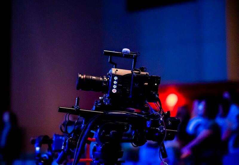
Equipment and Technology Used
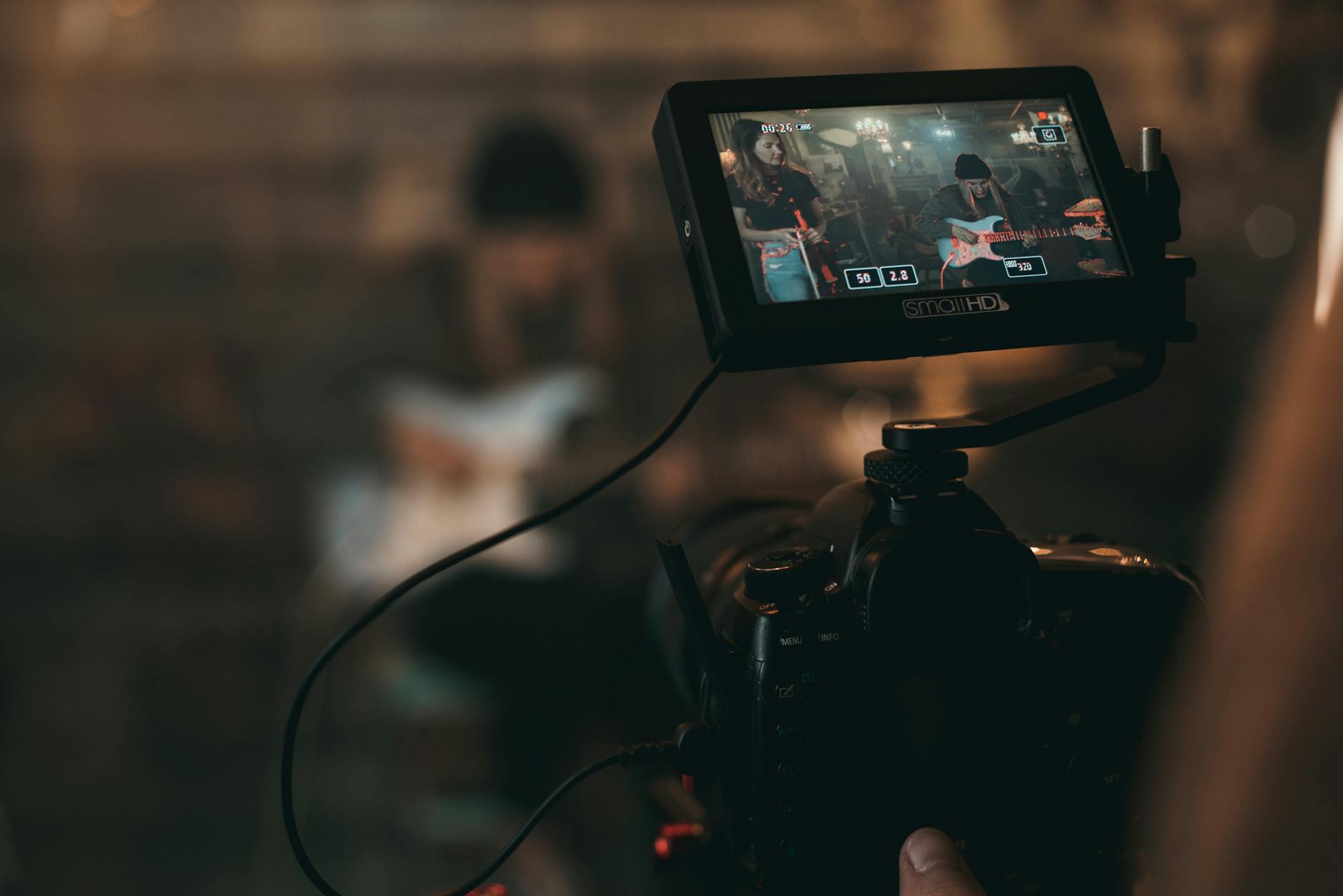
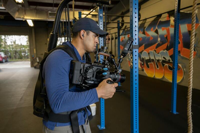
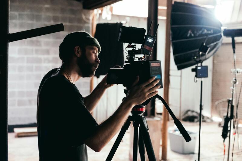
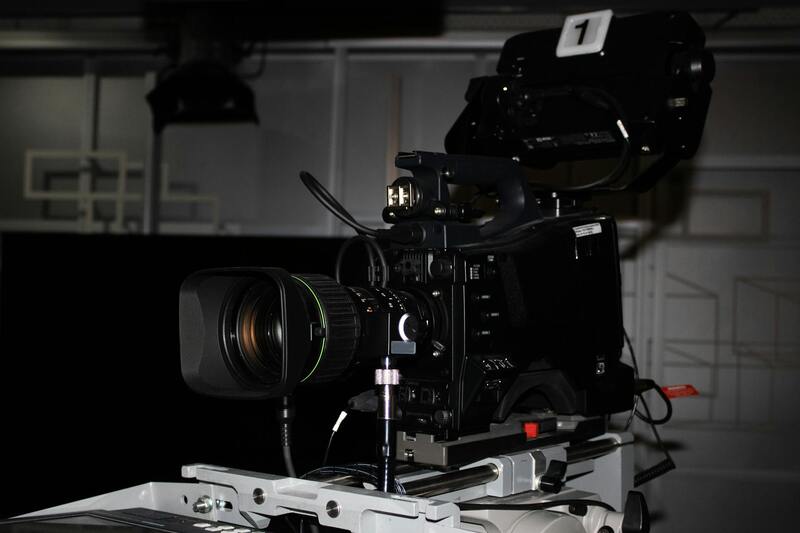
A professional drone real estate photographer relies on cutting-edge equipment to deliver high-quality images and footage. Drones equipped with high-resolution cameras—often with 4K or higher video capabilities—capture detailed aerial views that showcase property features effectively. Gimbal stabilization systems are essential for maintaining image clarity and smooth footage, especially during complex maneuvers. In addition, advanced flight controllers and GPS systems enhance flight stability and precise positioning, allowing for repeatable shots and safe navigation around complex terrains. Some operators also incorporate thermal imaging or HDR cameras to provide diverse visual options, especially for properties requiring specialized imaging. The use of modern software for flight planning and post-processing further elevates the quality of the final product. Flight planning tools enable pre-programmed routes, ensuring comprehensive coverage of property sites, while professional editing platforms refine images and videos to achieve optimal visual impact. Overall, investing in state-of-the-art equipment is fundamental for delivering exceptional results that meet client expectations and elevate property marketing efforts.
Capturing Effective Drone Real Estate Images
To maximize the visual appeal of drone-acquired images, certain techniques and best practices should be employed during flight to ensure compelling, professional results. This begins with optimal flight angles—overhead shots, oblique angles, and panoramic views all serve distinct purposes in highlighting a property’s size, layout, and surroundings. Lighting conditions play a vital role; scheduling shoots during early morning or late afternoon—golden hour—can provide softer, more flattering natural light, reducing harsh shadows and enhancing the property's features. Vertical and horizontal composition also matter, with balanced framing that accentuates key selling points and maintains visual symmetry. Keeping the drone at appropriate heights allows viewers to gain perspective without distorting scale, providing a sense of spaciousness while safeguarding privacy for neighboring properties. Additionally, capturing multiple shots from various angles ensures comprehensive coverage, facilitating a dynamic and engaging visual presentation. Finally, consideration of the property’s context—such as nearby amenities, scenic views, or unique architectural elements—adds depth to the visual story told through drone imagery. These meticulous practices ensure that each image not only showcases the property but also appeals emotionally to prospective buyers.
Editing and Post-Production of Drone Shots
Post-processing is a critical stage where raw drone footage and images are refined to maximize visual impact. This phase involves color correction, exposure adjustments, and noise reduction to ensure the images are vibrant and true to life. Enhancing contrast and sharpness can help highlight architectural details and landscape features, drawing viewers' eyes to key elements. Advanced editing techniques may include stitching multiple images for panoramic views or stabilizing shaky footage to produce smooth, professional videos. Some photographers also apply graduated filters or selective color adjustments to emphasize specific aspects of the property, such as lush landscaping or distinct structural features. Consistency in editing style across a series of images or videos enhances the overall quality of marketing materials, creating a cohesive visual narrative that appeals to potential buyers. Skilled post-production ensures that the final product not only accurately represents the property but also elevates its perceived value through meticulous enhancement.
Official and Legitimate Methods to Operate a Drone for Real Estate Photography in Miami
Performing drone photography for real estate purposes in Miami requires adherence to established procedures that ensure safe and compliant operations. The first step involves obtaining the appropriate certifications from recognized authorities, such as remote pilot certifications issued by the Federal Aviation Administration (FAA). These certifications validate that the operator has the necessary knowledge of airspace regulations, safety procedures, and operational protocols.
It is essential to register the drone with the FAA, particularly if the drone weighs more than 0.55 pounds. Registration numbers must be visibly marked on the aircraft, ensuring all devices are traceable and identifiable during operations. Maintaining proper documentation, including proof of certification and registration, is crucial when conducting commercial drone flights in a busy urban environment like Miami.
Prior to each flight, conducting a comprehensive risk assessment is vital. This involves evaluating weather conditions, assessing the surrounding environment for obstacles, and establishing safety buffers to prevent accidents. Many professionals utilize pre-flight checklists to verify that all safety protocols are followed, such as ensuring proper drone maintenance and calibrating sensors and autopilot systems.
Local airspace restrictions also guide legitimate drone operations. Miami’s dense urban landscape and proximity to airports like Miami International Airport necessitate liaising with relevant authorities or utilizing FAA-approved digital tools to check for temporary flight restrictions (TFRs). These TFRs may include special event area restrictions, temporary no-fly zones, or altitude limitations designed to safeguard other airspace users and the public.
In addition to federal regulations, compliance with Miami-specific ordinances related to drone usage in public spaces or private properties is strongly advised. Securing permissions from property owners before conducting aerial shoots, especially in restricted or private areas, helps prevent misunderstandings and ensures the shoot proceeds without issues.
Employing off-the-shelf drones designed for professional aerial photography allows operators to meet high standards of stability, image quality, and safety. Many advanced drones incorporate obstacle avoidance sensors, automatic return-to-home features, and geofencing capabilities that restrict flight within predefined zones. Utilizing these technologies aligns with responsible operating practices and enhances safety during property shoots.
Selecting reputable drone equipment from well-known manufacturers reduces the risk of technical failures during flights. Regular software updates and maintenance routines contribute to reliable performance, ensuring that each flight delivers high-quality imagery aligned with client expectations. Professional operators also carry liability insurance policies to mitigate potential risks associated with drone flights, offering additional safety assurance to clients and property owners.
Equipment and Technology Used
Professional drone real estate photographers rely on a sophisticated array of equipment and cutting-edge technology to deliver exceptional aerial images that showcase properties at their best. The foundation of high-quality drone photography begins with choosing the right unmanned aerial vehicle (UAV). Modern drones used in real estate are equipped with high-resolution sensors capable of capturing detailed images and ultra-clear videos. These devices often feature advanced stabilization systems such as gimbal stabilization, which ensures smooth footage even in challenging wind conditions, eliminating shaky or blurred images.
The cameras integrated into these drones are typically high-megapixel units with wide-angle lenses optimized for capturing expansive views of properties and surrounding landscapes. Many are capable of shooting in 4K or higher resolution formats, which allows for crisp, detailed visuals suitable for both print and digital marketing platforms. For strategic shots that require elevated perspectives or unique angles, photographers may utilize zoom functions or multi-axis gimbals that provide dynamic shot capabilities.
Beyond the drone and camera, stabilization tools play a crucial role in professional aerial photography. Gimbal stabilizers, often integrated into the drone hardware or as separate accessories, counteract unwanted movements, resulting in smooth, cinematic footage that highlights the property's best features. Additionally, flight controllers equipped with obstacle avoidance sensors ensure safe navigation around trees, power lines, and building structures, minimizing risks during complex shots.
Technological advancements such as GPS-based flight planning and automated flight modes allow precise positioning and repeatable shots, which is especially beneficial for creating consistent image portfolios. Some drones also incorporate thermal imaging sensors, useful for specialized real estate marketing or property inspections. Enhancements like extended flight times via high-capacity batteries enable comprehensive filming sessions without interruptions, capturing entire properties efficiently.
The integration of these advanced tools ensures that drone real estate photographers can deliver compelling visual content that resonates with target audiences, ultimately elevating a property’s appeal and helping it stand out in competitive markets.
Role of a Drone Real Estate Photographer
A drone real estate photographer serves as a critical asset for showcasing properties through captivating aerial imagery. Their expertise extends beyond simple flying skills; it involves a comprehensive understanding of real estate marketing, photography principles, and drone operation. These professionals analyze property features and identify the best angles and flight paths to highlight size, layout, and unique architectural elements.
By leveraging their technical proficiency, drone photographers can produce engaging visuals that capture the essence of a property and its surroundings. This includes framing shots that emphasize landscaping, external amenities, and neighborhood proximity. Their ability to adapt to varying environments, weather conditions, and property types ensures consistent delivery of high-quality images tailored to specific marketing needs.
The role also encompasses safety management, whereby drone operators follow established procedures to mitigate risks during flight, especially in populated or complex areas. This responsibilities include pre-flight planning, assessing environmental factors, and adhering to operating guidelines to ensure smooth, obstruction-free captures.
Moreover, a drone real estate photographer collaborates closely with real estate agents and marketing teams to strategize and optimize visual content for property listings. Their work contributes significantly to online marketing campaigns, virtual tours, and social media promotions, helping properties stand out in competitive markets. Their proficiency ensures the delivery of professional-grade footage and images, reinforcing listings’ appeal and attracting prospective buyers more effectively.
Advantages of Drone Photography in Real Estate
- Enhanced property visibility through striking aerial views.
- Showcase of property size and layout from unique perspectives.
- Highlighting external amenities such as pools, gardens, and patios.
- Creating immersive experiences for potential buyers with virtual tours.
- Improved online listing engagement by offering dynamic content.
Legal and Regulatory Considerations
When employing drone technology in real estate photography, professionals strictly adhere to established operational standards to ensure responsible use. This includes performing detailed pre-flight evaluations, planning flight paths that avoid restricted airspaces, and maintaining a safe distance from populated areas. Operators also verify weather conditions to prevent unsafe flying circumstances, ensuring consistent quality in aerial footage.
By following these procedural guidelines, drone photographers maintain compliance with aeronautical rules and coordinate effectively with local authorities when necessary. They also keep abreast of any updates to operational requirements, fostering a culture of safety and professionalism that benefits clients and the broader community.
Equipment and Technology Used
A professional drone real estate photographer employs a combination of advanced drones, high-resolution cameras, and stabilization accessories to produce superior imagery. Drones equipped with GPS-based flight controllers enable precise control and repeatability for consistent shot composition. Integrated obstacle avoidance sensors facilitate safe navigation around complex terrains and structures, allowing for complex shots in tight spaces.
The core camera gear typically includes high-definition, wide-angle lenses capable of capturing expansive landscapes and detailed architectural features. Gimbal stabilizers help achieve smooth, cinematic footage by counteracting drone movement, resulting in visually appealing images that emphasize property's strengths. Battery management systems with extended flight times allow for comprehensive coverage of large estates, ensuring efficient use of time and resources.

Legal and Regulatory Considerations
Ensuring compliance with established operational standards is crucial for drone real estate photography. Professional drone operators adhere to specific guidelines that govern where and how drones can be flown to guarantee safe and responsible operations. This includes respecting no-fly zones around airports, protected natural areas, and densely populated urban centers. Prior to any shoot, a thorough assessment of the location is undertaken to identify potential hazards and to establish a safe flight plan that minimizes risk.
Operators typically acquire necessary certifications and permissions from relevant authorities, which may involve submitting flight plans or obtaining permits for aerial photography in certain areas. This process ensures that all activities are authorized, providing peace of mind for clients and stakeholders. Maintaining current knowledge of any updates to rules and operational procedures is an ongoing responsibility for professionals in this field, supporting a culture of safety and operational excellence.
Effective communication with local authorities and adherence to prescribed flight restrictions contribute to smooth operations, avoiding potential disruptions or legal issues. Skilled drone photographers meticulously plan each project, ensuring all permissions are in place and safety measures are followed diligently. This disciplined approach not only upholds the integrity of the work but also reflects professionalism that clients trust and rely upon.
Combining responsible operational practices with advanced equipment allows drone real estate photographers to deliver stunning visuals while respecting the operational environment. This responsible approach supports the broader goals of safety, security, and efficiency, ultimately enhancing the reputation of the drone photography industry within the real estate market.
Role of a Drone Real Estate Photographer
Drone real estate photographers play a pivotal role in modern property marketing by providing comprehensive aerial visuals that showcase properties from unique perspectives. Their expertise lies not only in capturing striking images but also in understanding the nuances of drone operation, camera settings, and environmental factors that influence shot quality. These professionals meticulously plan each shoot, considering weather conditions, lighting, and property layout to produce images that highlight the property’s best features effectively.
Beyond technical skills, a drone photographer must possess an innate sense of composition, framing, and timing to create compelling visuals. They work closely with real estate agents, developers, and homeowners to align imagery with marketing strategies, ensuring each shot enhances property appeal. Their role extends to understanding the subtle legal parameters governing aerial photography, ensuring all flights are conducted within sanctioned operational boundaries and safety protocols are strictly followed.
Advantages of Drone Photography in Real Estate
Employing drone technology significantly boosts the visibility and attractiveness of property listings. Aerial images provide comprehensive views of the property’s exterior and surrounding amenities, such as gardens, pools, and neighboring features, giving prospective buyers an immersive experience. This perspective is particularly beneficial for large estates, waterfront properties, and developments with extensive grounds, where conventional photography may fail to capture the full scope.
Drone images also facilitate the presentation of unique property angles, panoramas, and virtual walkthroughs. These visuals help buyers assess spatial relationships and property scale quickly and accurately, leading to more informed decision-making. Additionally, professional drone imagery can speed up the sales process by attracting more inquiries and generating higher levels of engagement on online platforms.
Legal and Regulatory Considerations
While drone photography offers unmatched marketing advantages, it requires adherence to established operational standards. Ensuring proper permissions, understanding restricted zones, and complying with flight protocols are fundamental components of responsible drone use. Professionals invest in continuous education and certification courses to stay updated on industry best practices, which enhances their ability to operate safely and ethically within designated airspaces.
Moreover, documenting flight plans and maintaining clear communication with local authorities is crucial. This not only demonstrates compliance but also safeguards the integrity of the project, providing peace of mind to all stakeholders involved. By following these measures, drone real estate photographers can deliver high-quality visuals without compromising safety or operational standards.
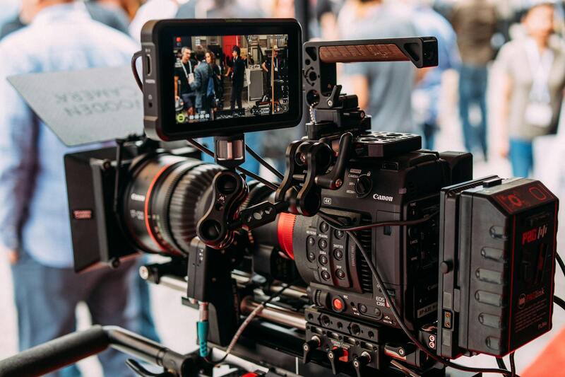
Equipment and Technology Used
The backbone of professional drone real estate photography is quality equipment. Modern drones equipped with high-resolution cameras, gimbals for stabilization, and advanced flight control systems are standard. High-end cameras capable of capturing 4K or higher resolution footage, along with wide-angle lenses, are essential for producing detailed and expansive views that effectively showcase properties.
Additional tools such as GPS modules, obstacle avoidance sensors, and flight planning software enable precision flying and safe operations. Some photographers invest in multifaceted drones capable of both aerial photography and videography, providing clients with versatile content tailored for diverse marketing platforms. The integration of emerging technologies, like automated flight paths and real-time image transmission, further enhances efficiency and shot quality.
Capturing Effective Drone Real Estate Images
Achieving captivating drone images involves strategic planning and technical adjustments. Photographers consider the sun’s position to optimize lighting and minimize shadows, capturing images during the golden hours of sunrise or sunset for warm, inviting visuals. Altitude and angle selection are tailored to highlight key property features, whether a sprawling estate or a compact urban condo.
Utilizing panoramic shots and sweeping aerial views, professionals create compelling narratives that draw viewers into the property’s story. Maintaining a consistent stylistic approach—such as specific color grading or framing standards—ensures cohesive visual branding across property listings. The importance of stabilizing equipment cannot be overstated, as it results in smooth, professional-grade footage free from jittery movements that can detract from the visual experience.
Editing and Post-Production of Drone Shots
Post-production enhances drone imagery through meticulous editing. Color correction adjusts hues and contrasts to make images appear more vivid and true-to-life, accentuating the property’s appeal. Stitching together multiple images for panoramic views requires precise alignment to produce seamless, expansive backgrounds. Additionally, removing minor distortions or unwanted objects through retouching ensures the final visuals are polished and professional.
Many drone photographers employ advanced software to stabilize footage, add motion effects, or create dynamic video tours. These enhancements not only improve aesthetic quality but also serve marketing purposes by providing engaging content that captures attention. High-resolution exports, optimized for various digital platforms, allow real estate agents to maximize their reach and impact.
Role of a Drone Real Estate Photographer
Drone real estate photographers play a pivotal role in modern property marketing by providing unique aerial perspectives that ground-level photography cannot achieve. Their expertise extends beyond mere flying; it includes a deep understanding of camera technology, flight safety protocols, and the nuanced requirements of real estate marketing. They skillfully capture images and videos that showcase the full scope of a property, highlighting its size, landscape, and surrounding amenities. With a keen eye for composition, a drone photographer ensures each shot accentuates the property’s strengths, whether it’s expansive outdoor spaces, proximity to key neighborhood features, or architectural details that set the property apart.
Beyond capturing stunning visuals, drone real estate photographers often collaborate with real estate agents and property marketers to develop compelling visual narratives. They understand the importance of conveying scale and context, helping potential buyers visualize themselves in the space. The role also involves adhering to strict flight protocols, ensuring safety and compliance with regulations while capturing footage in various environments. Their ability to work efficiently under different lighting conditions and weather patterns ensures consistent delivery of high-quality content, which is crucial for competitive real estate markets such as Miami.
Advantages of Drone Photography in Real Estate
- Enhanced Property Visibility: Aerial images stand out among traditional photos, attracting more online views and interest.
- Showcase of Surroundings: Establishing a property within its neighborhood context can be vital for buyers considering location and amenities.
- Highlighting Property Features: From swimming pools to outdoor entertainment areas, drone captures reveal features that might be missed in still photos.
- Virtual Tours Integration: Drone footage enhances virtual walkthroughs, providing immersive experiences that can accelerate decision-making.
- Improved Marketing Appeal: Professionally captured aerial visuals contribute to a polished, credible listing that boosts perceived value.
Legal and Regulatory Considerations
Utilizing drone technology for real estate marketing requires adherence to established operational standards that prioritize safety and privacy. Operators must stay updated on local regulations governing drone flights, which often include restrictions on altitude, flight zones, and privacy considerations. Gaining proper certifications and permits ensures that drone activities are conducted responsibly and without disrupting neighboring properties or airspace. Here in Miami, specific guidelines govern the use of unmanned aerial vehicles, requiring drone operators to operate within designated areas, avoid restricted zones, and respect the privacy of residents.
Equipment and Technology Used
State-of-the-art drone models equipped with high-resolution cameras are fundamental to capturing superior real estate imagery. Multirotor drones equipped with gimbal stabilization systems ensure smooth footage even in windy conditions, providing steady, cinematic shots. High-quality lenses and sensors enhance detail and color accuracy, vital for showcasing property features accurately. Additionally, advanced software is employed for flight planning, image stitching, and post-processing, enabling photographers to deliver polished visuals efficiently. As technology advances, features such as 4K video recording, obstacle avoidance sensors, and automated flight paths are becoming standard, increasing the safety and quality of drone shots.
Capturing Effective Drone Real Estate Images
Effective drone imagery hinges on strategic planning and execution. Pre-shoot planning involves evaluating the property layout, determining the optimal times for lighting conditions, and identifying angles that best showcase key features. Flight paths should be carefully mapped to capture wide-angle shots that emphasize property size and landscape. Maintaining a consistent altitude and perspective contributes to a cohesive visual story. It’s essential to avoid excessive camera tilt or skewed angles that can distort the property’s proportions. During the shoot, operatorsmust monitor battery life to maximize coverage without compromising safety or image quality. Using neutral filters or polarizers can help manage reflections and improve color fidelity in bright conditions.
Editing and Post-Production of Drone Shots
Post-production processes refine drone footage to ensure professional-grade presentation. Color correction boosts vibrancy and contrast, producing images that look both vivid and true-to-life. Stitching software allows for the creation of expansive panoramic views that illustrate the property’s full scope. Removing minor distortions or undesired elements with retouching tools enhances visual clarity. Many professionals also incorporate motion effects in video tours or add branding elements to align visuals with marketing strategies. Exporting high-resolution files tailored to various digital platforms maximizes their impact, ensuring that when viewed online or in promotional materials, the images and videos are crisp and engaging.
Choosing a Drone Real Estate Photographer in Miami
Selecting a professional drone photographer in Miami involves evaluating their experience, portfolio, and compliance with standards. An accomplished photographer demonstrates a deep understanding of real estate marketing objectives and technical proficiency with relevant equipment. Their portfolio should showcase a variety of property types, from luxurious estates to urban condominiums, illustrating versatility and attention to detail. Local expertise is crucial; Miami’s diverse terrains and regulatory landscape demand familiarity with specific flight zones and environmental conditions. Additionally, professional credentials, insurance coverage, and positive client testimonials are indicators of reliability and quality. Partnering with a reputable drone real estate photographer ensures access to top-tier visuals that elevate property listings and set them apart in a competitive market.