Introduction to Aerial Videography in Real Estate
In the highly competitive real estate market, visual presentation plays a pivotal role in attracting potential buyers and investors. Over the past decade, aerial videography has emerged as a transformative tool in property marketing, offering a unique perspective that traditional ground-level footage simply cannot match. Through professionally executed aerial videos, real estate professionals can showcase a property's entire scope, surrounding landscape, neighborhood amenities, and tailored features from an elevated vantage point.
This innovative approach significantly enhances the overall appeal of property listings, creating a compelling narrative that resonates with prospective clients. In particular, high-quality aerial videography captures the grandeur of estates, the strategic location of commercial properties, and the scenic beauty of waterfront homes with remarkable clarity and detail. It allows viewers to visualize not only the property itself but also its context within the community, thereby delivering an immersive experience that encourages engagement and facilitates quicker decision-making.
Furthermore, the integration of dynamic aerial footage into marketing campaigns has proven to influence buyer perception positively. A well-produced video can evoke an emotional response, emphasize the property's unique selling points, and differentiate listings in a crowded marketplace. The immersive quality of high-definition aerial videography not only boosts online engagement but also elevates a real estate agent’s professional image and credibility, making it an essential component of modern property promotion strategies.
As technology advances, the quality and accessibility of aerial videography continue to improve, empowering real estate marketers to produce visually stunning content with relative ease. This trend underscores the increasing importance of aerial footage in creating compelling, informative property presentations that meet the expectations of today's digital-savvy buyers.
Legal and Regulatory Considerations
Implementing real estate aerial videography involves adherence to specific procedures and standards designed to ensure safe and responsible drone operations. These procedures include obtaining the necessary permits and adhering to established flight guidelines that regulate where and how drones can be operated. Securing permits typically involves submitting detailed flight plans, demonstrating competency, and verifying insurance coverage to authorities overseeing aerial activities. Compliance with these procedures ensures that videography efforts are conducted within the scope of local regulations, avoiding any operational disruptions.
Operators must also be mindful of adherence to airspace rules, which vary depending on the location and the proximity to airports, heliports, or other sensitive areas. Properly notifying relevant authorities and maintaining communication during filming sessions minimizes potential conflicts and enhances safety measures.
Furthermore, operators are expected to follow prescribed safety protocols, such as pre-flight inspections, maintaining visual line-of-sight with the drone, and respecting altitude limitations. These guidelines not only promote safety but also contribute to the production’s smooth execution. Establishing a clear understanding of these official requirements allows for seamless integration of aerial videography into property marketing efforts, ensuring that projects are executed professionally and efficiently.

Permitting Process
- Submit detailed flight plans outlining altitude, duration, and location specifics.
- Demonstrate drone operation competency through certification or experience records.
- Secure necessary permits from local or federal aviation authorities before scheduling shoots.
Airspace and Safety Regulations
- Maintain visual line-of-sight with the drone, avoiding obstructions and other aircraft.
- Respect altitude restrictions typically set by governing bodies, often around 400 feet or lower.
- Avoid operating near sensitive sites such as airports, helipads, or densely populated areas without explicit permissions.
Operational Best Practices
- Conduct thorough pre-flight inspections to confirm equipment safety and functionality.
- Plan flights during optimal weather conditions to minimize risk and maximize footage quality.
- Implement emergency procedures and have communication protocols established during the shoot.
Securing Official Permits and Authorizations for Aerial Filming
To operate drones for real estate aerial videography in accordance with official standards, acquiring the proper permits is an essential step. This process begins with submitting comprehensive flight plans to relevant authorities, which should detail the specific locations, altitudes, and durations of planned shoots. Clear demonstrations of operational competence, often through certification or documented experience, bolster the application's credibility and streamline approval procedures.
Once submitted, applications undergo review by designated agencies responsible for airspace management and safety oversight. Approval is typically contingent upon adherence to established flight parameters, clear safety protocols, and comprehensive risk assessments. Securing these permits ensures that aerial filming activities are conducted within authorized boundaries, aligning with federal, state, and local guidelines.
It is important to maintain meticulous documentation of all permits and approvals obtained, as they serve as verification of compliance during inspections or audits. Additionally, fostering good communication with regulatory bodies can facilitate smoother approval processes for future projects. By thoroughly understanding the official requirements and proactively managing the permit acquisition process, operators can significantly reduce the risk of project delays or disruptions, allowing for a seamless integration of aerial footage into property marketing campaigns.
Ensuring Compliance with Airspace and Safety Regulations
Operational safety and adherence to airspace regulations are fundamental to responsible aerial videography. Maintaining visual contact with the drone at all times minimizes flight risks and enables real-time responses to unexpected obstacles. Operators must observe altitude limits—commonly around 400 feet—unless otherwise authorized, to prevent interference with manned aircraft and other aerial activities.
Operating near sensitive locations, such as airports, helipads, or densely populated areas, requires explicit permissions and strict adherence to safety buffers. Respecting no-fly zones and airspace restrictions helps prevent safety incidents and ensures smooth coordination with air traffic management authorities.
Rigorous pre-flight checks are mandatory to verify equipment integrity, including battery levels, camera stability, and drone navigation systems. Selecting appropriate weather conditions—clear skies, calm winds, and minimal precipitation—is vital to capture high-quality footage while minimizing operational risks. Establishing emergency procedures, such as planned contingency plans for hardware failure or weather changes, enhances safety and project professionalism. Clear communication protocols between crew members facilitate coordinated efforts during complex flight operations, thereby maintaining efficiency and safety throughout each shoot.
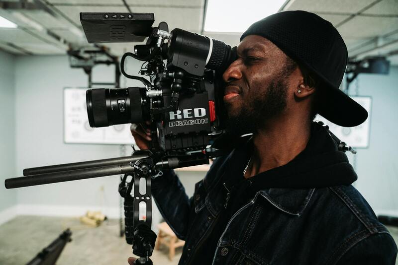
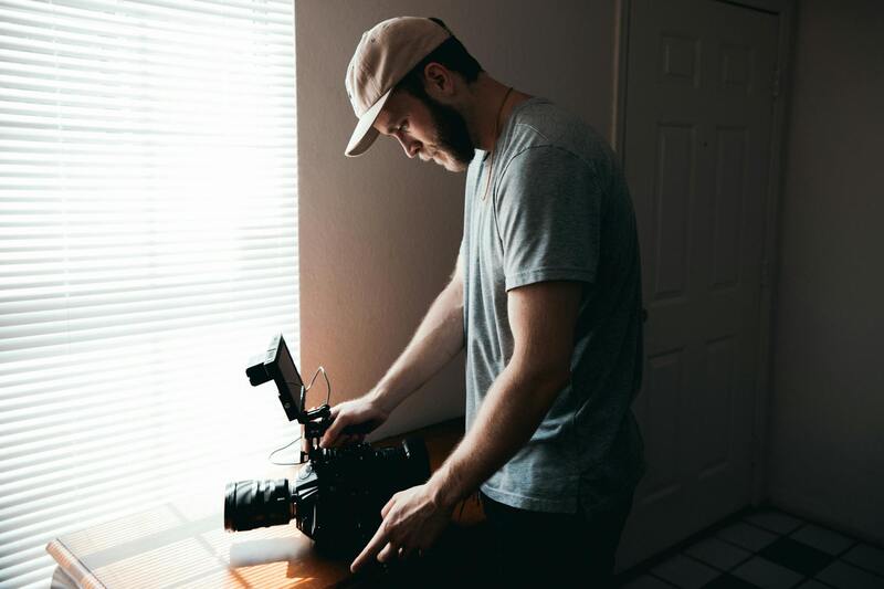
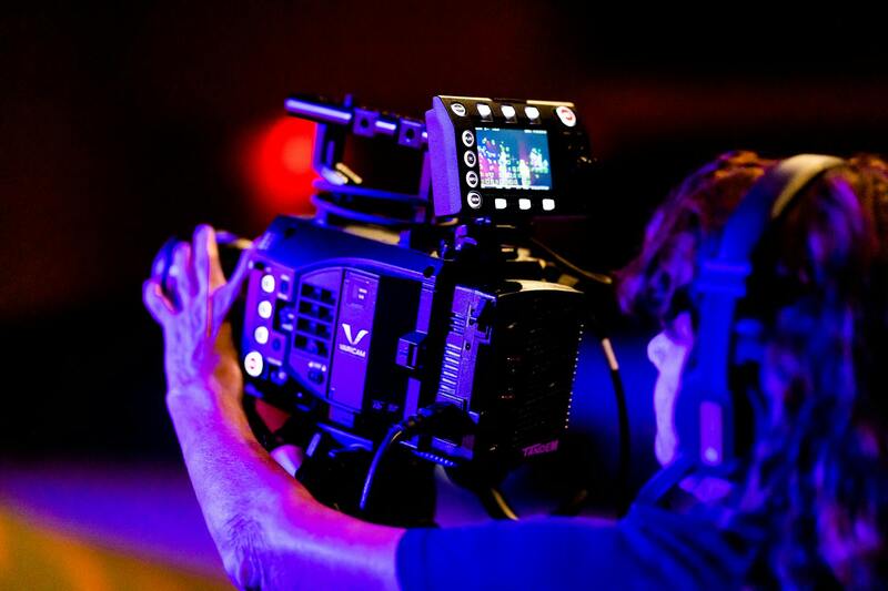
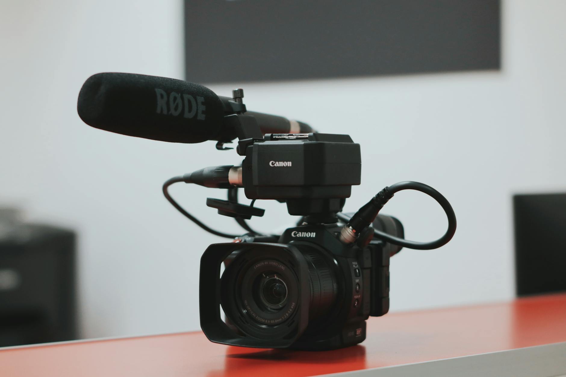
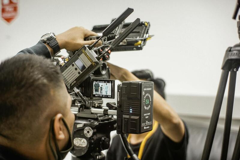
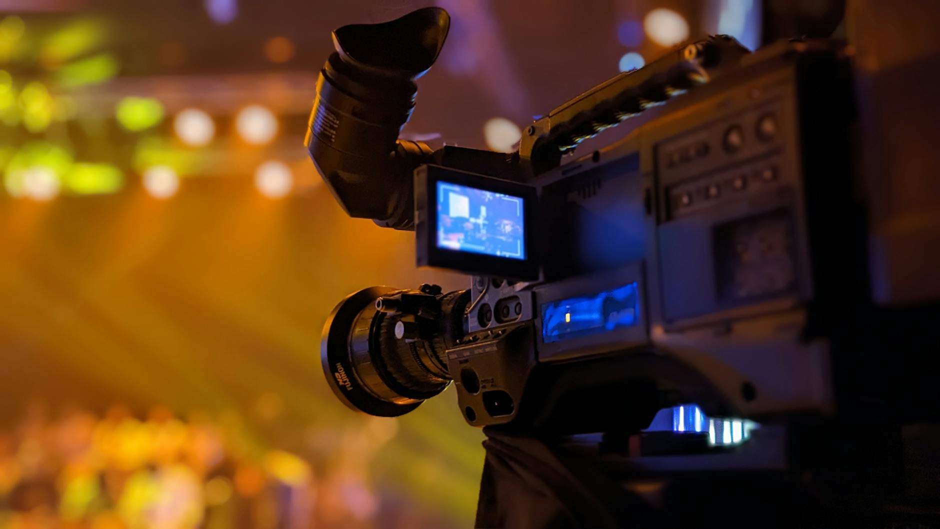
Equipment and Technology Used
Optimal aerial videography relies on cutting-edge technology and specialized equipment designed for precise and high-quality image capturing. The core of any successful project involves the selection of drones equipped with high-resolution cameras capable of capturing detailed footage from various altitudes and angles. These devices often incorporate advanced stabilization systems, such as 3-axis gimbals, to ensure smooth, jitter-free videos even in challenging wind conditions.
Modern aerial platforms utilize GPS-based navigation systems that allow for precise flight path programming and autonomous flight modes, thereby increasing efficiency and repeatability in shoot setups. Additionally, these drones come with automated obstacle avoidance sensors, which detect and navigate around potential hazards, reducing the risk of accident or damage.
For professional-grade footage, operators may employ drones with interchangeable lenses, allowing tailored optics for wide-angle landscapes or detailed close-ups of property features. High dynamic range (HDR) sensors are also becoming standard, capturing footage that maintains clarity and color accuracy across varying lighting conditions.
Alongside drones, supplementary equipment such as portable lighting, external microphones, and stabilization rigs may be employed in complex shoots to optimize audiovisual quality. These tools ensure that both aerial and ground-based footage seamlessly integrate, delivering a comprehensive visual story of the property. The integration of software solutions for flight planning and post-processing further elevates the production quality. Flight planning apps help create efficient, regulated flight paths, while editing platforms enable precise color grading, stabilization, and seamless stitching of aerial shots into cohesive videos. The combination of sophisticated hardware and intelligent software enables a professional workflow that enhances the final product.
Legal and Regulatory Considerations
Ensuring compliance with current guidelines and regulations is a fundamental aspect of professional real estate aerial videography. Operators must adhere to established standards for drone operations, which often include restrictions on flight altitude, designated no-fly zones, and privacy considerations. Proper authorization and adherence to local airspace policies help maintain safety and professionalism during shoots.
Before any flight takes place, thorough planning involves verifying airspace permissions, especially in urban settings like Miami where many areas may be subject to specific regulations. This process includes submitting necessary documentation and securing permits when required, which ensures that footage collection aligns with official frameworks. In some cases, coordination with local authorities or aviation bodies is essential for unrestricted access to certain airspace segments.
Operators also conduct comprehensive site assessments to identify potential hazards such as power lines, tall structures, or dense crowd areas. Employing official geofencing tools and regulatory maps provided by aviation authorities helps avoid accidental incursions into restricted zones, thereby preventing disruptions or penalties. Maintaining detailed records of flight plans and permissions further supports accountability, demonstrating compliance with regional standards and fostering trust with clients and stakeholders.
In addition, utilizing certified and calibrated equipment ensures the safety and quality of aerial footage, aligning with established operational protocols. Proper maintenance and regular updates to drone firmware, along with thorough training for operators, reinforce best practices that support a smooth, compliant production process.
Equipment and Technology Used in Real Estate Aerial Videography
Advancements in drone technology have revolutionized the way real estate professionals create captivating visual content. Modern aerial videography relies on high-resolution cameras mounted on sophisticated drones equipped with stabilization systems, allowing for smooth and visually appealing footage. These cameras often feature 4K or higher resolution capabilities, ensuring that every detail of a property is captured with clarity and precision.
To achieve professional-grade results, operators utilize advanced stabilization gimbals that counteract drone movements, enabling steady shots even in challenging wind conditions or uneven terrains. Additionally, multirotor drones with GPS-based hover capabilities allow for precise positioning, essential for highlighting key property features during the shoot.
Battery technology is another critical aspect, with high-capacity batteries providing longer flight times—often exceeding 25-30 minutes—per charge. This extended operational window allows for more comprehensive coverage of large properties without frequent interruptions. Moreover, many drones now incorporate obstacle avoidance sensors, contributing to safer flights and minimizing the risk of accidents or equipment damage.
In terms of software, flight planning applications facilitate pre-programmed routes and automated flight paths, reducing human error and optimizing coverage. Advanced editing tools integrated with these systems enable quick adjustments and integration of cinematic effects, crucial for producing engaging property videos that stand out on digital platforms.
Working with aviation-grade equipment and the latest technology ensures the production of high-fidelity footage that can effectively showcase a property's unique features, attracting potential buyers and elevating online listings.

Legal and Regulatory Considerations for Real Estate Aerial Videography
Implementing aerial videography within the real estate industry requires adherence to established guidelines that govern drone operations, ensuring safety and compliance during all phases of filming. Professionals engaged in this domain must keep abreast of the latest regulations related to airspace management, flight altitude, and privacy standards. This includes understanding restrictions associated with certain zones, such as airports, residential areas, or government facilities, where additional permissions or specialized approvals are necessary.
Proper planning involves verifying no-fly zones and local ordinances that may affect aerial footage collection. Utilizing resources such as official maps or authorized registries helps in determining permissible flight areas, reducing the risk of inadvertent violations. Furthermore, obtaining required authorizations, like operational permits issued by relevant authorities, ensures a seamless filming process that aligns with regional mandates.
Operational best practices involve establishing clear flight safety protocols. Pilots often conduct detailed pre-flight assessments of weather conditions, potential obstacles, and designated safe zones. This proactive approach minimizes risk and enhances the quality of footage captured. Maintaining comprehensive documentation of flight plans, authorization approvals, and safety procedures fortifies reliability and demonstrates professional diligence.
For agencies offering aerial videography services, regular training and licensing updates are vital. Certifications, including those for drone pilots that meet required standards, showcase technical competence and commitment to responsible operation. Leveraging advanced pre-flight planning software can further optimize flight routes, ensuring comprehensive coverage of property sites while conforming to established guidelines.
By integrating these structured methodologies, real estate professionals and videographers can produce captivating aerial content that not only highlights property features but also aligns with the highest standards of responsible drone use. This disciplined approach fosters trust with clients and reinforces the credibility of the service provider within the competitive Miami real estate market.
Legal and Regulatory Considerations
When engaging in real estate aerial videography, understanding and adhering to official procedures ensures a smooth operational process. It’s essential to coordinate with appropriate authorities and utilize platforms like drone registration portals to formally document each flight operation. This practice facilitates transparency and helps prevent operational interruptions. Maintaining detailed records of flight plans, authorization approvals, and safety protocols is fundamental for demonstrating compliance and operational integrity.
Prior to filming, conducting comprehensive assessments of the shooting location is critical. This includes evaluating surrounding structures, designated no-fly zones, and airspace restrictions that might impact flight paths. Employing geo-fencing technology integrated into modern drones can help enforce virtual boundaries, preventing inadvertent incursions into restricted areas.
Operators should also stay informed about local ordinances that regulate drone use. Many regions have specified altitude limits and time-of-day operating windows, which are designed to enhance safety and privacy. In Miami and similar urban environments, respecting these parameters is vital. Regularly consulting official updates from aviation authorities and regional governing bodies ensures that drone activities remain aligned with current requirements.
Security and privacy considerations also play a critical role. When planning a shoot, it’s important to communicate with property owners about the scope and coverage of the aerial footage. Respecting neighboring privacy rights and avoiding capture of sensitive or restricted sites safeguards both client interests and the reputation of the service provider.