Role of Drone Photography in Real Estate Marketing
In the competitive landscape of the Miami real estate market, visual presentation plays a pivotal role in attracting prospective buyers and investors. Drone photography has revolutionized property marketing by providing stunning aerial perspectives that traditional ground-level photos cannot capture. These high-quality images deliver a comprehensive view of the property, encompassing the surrounding landscape, nearby amenities, and the overall neighborhood ambiance.
Using drone images allows real estate agents and property owners to highlight unique selling points of a property, such as expansive yards, waterfront access, scenic views, or distinctive architectural features. These captivating visuals stand out in online listings, brochures, and virtual tours, effectively drawing attention and generating increased interest.
The impact of drone photography extends beyond mere aesthetic appeal. Aerial images can depict the spatial relationships between neighboring properties, accessibility to major roads, parks, schools, and commercial hubs — all critical factors for potential buyers assessing the suitability of a property.
Additionally, the use of dynamic drone footage, including panoramic shots or flyovers, creates engaging content that enhances virtual tours and online marketing campaigns. This immersive experience enables viewers to gain a deeper understanding of the property's scale, layout, and setting, fostering an emotional connection that can accelerate decision-making.
In an era where online listings are often the first touchpoint for buyers, high-quality drone imagery contributes significantly to the perceived professionalism and credibility of a property listing. It underscores the commitment to quality and attention to detail that discerning buyers expect.
Correlation Between Drone Photography Quality and Property Price
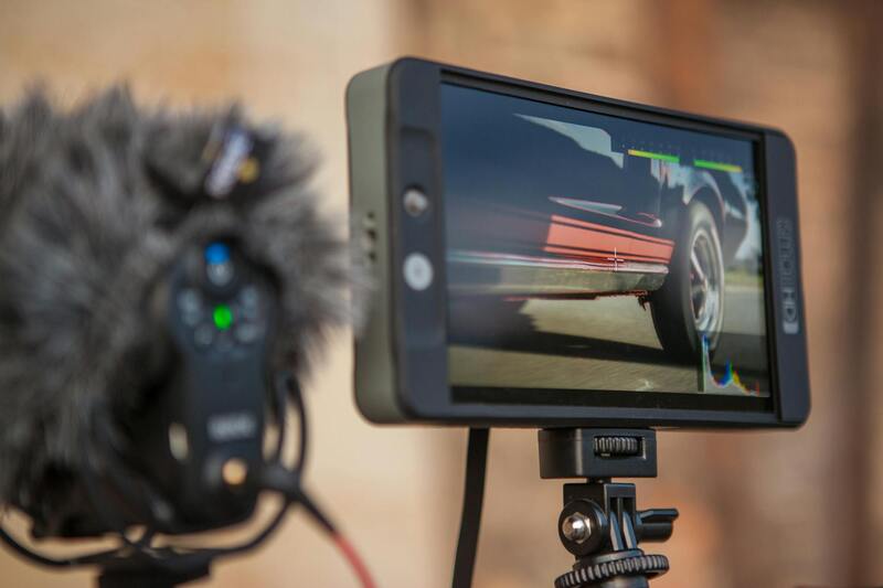
The quality of drone images plays a pivotal role in influencing a property's market value. High-resolution, well-composed aerial photographs can significantly enhance the visual appeal of a listing, making it stand out in a crowded real estate market. Superior drone footage captures sharp details, vibrant colors, and smooth motion, all of which contribute to a more compelling presentation.
Research indicates that properties showcased with top-tier aerial imagery tend to attract higher offers and generate more interest from prospective buyers. This correlation hinges on the perception of the property's overall quality and the professionalism conveyed through the visuals. When drone images accurately showcase the property's best features, such as expansive yards, waterfront access, or proximity to desirable amenities, they reinforce the property's perceived value.
Moreover, consistent use of high-quality aerial shots across a real estate portfolio can elevate the overall market position of a realtor or agency. It signals a commitment to excellence and can establish a reputation for premium marketing practices. This reputation can translate into faster sales cycles and better pricing, especially in competitive markets like Miami.
Buyers are increasingly relying on online listings as their initial point of contact with a property. Listings enriched with professionally crafted drone images provide a more accurate and attractive depiction of the property’s full potential. When potential buyers perceive a listing as polished and comprehensive, their confidence in the property's value increases, often leading to stronger offers.
In essence, investing in premium drone photography can be a strategic decision that elevates a property's market position. For property sellers and real estate professionals in Miami, understanding the linkage between image quality and pricing underscores the importance of leveraging advanced aerial imaging as a core component of their marketing strategy.
Correlation Between Drone Photography Quality and Property Price
High-caliber drone imagery has become a crucial element in Miami's real estate landscape, directly influencing property valuation and buyer perception. The clarity, resolution, and composition of aerial shots can significantly alter a property's market appeal. Aimed at capturing expansive views, unique architectural details, and the surrounding environment, professional drone images serve as a visual testament to a property’s desirability.
Research and market analysis in Miami reveal a consistent trend: properties showcased with superior aerial photography tend to command higher asking prices. This is especially evident in neighborhoods where scenic views, waterfront access, or sprawling grounds are major selling points. Well-executed drone images not only attract more online views but also foster trust, making buyers more willing to consider premium offers.
Fundamentally, the effectiveness of drone photography in influencing property prices hinges on several factors: image resolution, clarity, timing, and composition. When aerial shots accurately depict the full scope of a property, including terrain, landscaping, and nearby amenities, they help buyers understand the true potential of a listing. Moreover, professional drone operators utilize advanced techniques such as optimal flight patterns and post-processing enhancements to ensure images are vibrant, sharp, and engaging.
For real estate professionals, investing in quality drone photography is not merely about aesthetics; it’s about strategic positioning. Listings with compelling, high-resolution aerial images tend to perform better in competitive markets like Miami, where visual appeal has a direct link to perceived worth. These images can effectively differentiate a property from others that lack such dynamic visuals.
Additionally, drone images facilitate a more comprehensive understanding of property boundaries and land features, which are often critical considerations for buyers. When buyers receive a clear, detailed visual narrative, their confidence in the property’s value is reinforced, frequently translating into more competitive offers. Real estate agents who leverage top-tier drone visuals typically see faster sales cycles and better pricing outcomes.
Impact of Image Resolution and Composition on Property Valuation
High-quality drone images play a pivotal role in shaping prospective buyers' perception of a property’s true worth. The resolution of aerial photographs determines the level of detail that viewers can discern, facilitating an accurate assessment of the property’s features, land contours, and landscaping. Clear, sharp images serve as a visual affirmation of quality, resonating with buyers who associate pristine visuals with premium properties.
Beyond resolution, the composition of drone shots influences how effectively a property is positioned in the market. Optimal framing highlights key features such as swimming pools, outdoor living spaces, and architectural details, which can elevate the perceived value. By strategically capturing various angles and elevations, drone photography provides a holistic view that static ground-level photos often cannot achieve. This comprehensive perspective helps potential buyers visualize the property's full potential, thereby heightening their interest and willingness to pay a competitive price.
Post-processing techniques further enhance the effectiveness of drone imagery. Adjustments such as color correction, contrast enhancement, and HDR processing ensure that aerial visuals are vibrant and attention-grabbing. These professional enhancements contribute to a seamless visual experience, reinforcing the property's desirability and justifying higher asking prices.
Strategic Use of Timing and Flight Patterns
The timing of drone captures significantly affects image quality and the emotional impact conveyed. Shooting during the golden hour—shortly after sunrise or before sunset—provides warm, soft lighting that accentuates textures and landscape features, creating inviting visuals that appeal to buyers. Additionally, well-planned flight paths that encompass the entire property and surrounding amenities help craft a compelling visual story. Dynamic shooting techniques, such as orbital shots or elevation climbs, reveal aspects of the property that static images may overlook, further influencing valuation.
Incorporating specific flight patterns enables the highlighting of property boundaries, driveway layouts, and proximity to local attractions—details that can sway pricing narratives. When these images accurately reflect the property's surroundings and scale, they foster a sense of authenticity and transparency, which are essential in establishing value.
Overall, the blend of technical image quality, strategic composition, and timing in drone photography creates a powerful tool for real estate marketing. It delivers a detailed, immersive experience that not only attracts buyer interest but also plays a crucial role in substantiating the property’s market value, particularly in competitive markets like Miami where visual impact is paramount.
Optimizing Property Pricing with High-Quality Drone Imagery
Accurate and compelling drone images serve as a critical component in establishing appropriate property prices within Miami's competitive real estate market. When high-resolution aerial shots clearly highlight the expansive nature and unique features of a property, they enhance early buyer engagement by providing a comprehensive view that static images often cannot deliver. This immersive perspective allows prospective buyers to better assess land size, outdoor amenities, and proximity to key attractions or infrastructure, thereby influencing their perception of overall value. In the context of pricing strategy, drone images that depict the property’s surroundings with clarity and precision aid real estate professionals in positioning listings at an optimal price point. For example, showcasing large, well-maintained outdoor spaces or highlighting the property's scenic views can justify asking prices at the higher end of the market. Conversely, images that reveal issues such as encroachment, proximity to busy roads, or neglected landscaping can signal the need for price adjustments. Furthermore, integrating drone footage into overall marketing efforts enhances the listing’s visibility on digital platforms, increasing the likelihood of attracting serious buyers. Increased exposure often correlates with quicker sales, reducing holding costs and providing a slight leverage in negotiations. Effective drone imagery can also support detailed property valuations by providing verified visual evidence that aligns with appraisal reports, leading to more substantiated asking prices. Visual consistency and professionalism in aerial shots underpin trust and perceived authenticity, which are vital in establishing a property’s true market worth. When these images are combined with precise property data and market analysis, they form a robust foundation for setting competitive and realistic prices, ensuring that listings attract high-quality offers while maximizing return for sellers.
Optimizing Property Pricing Through Drone Image Quality
High-caliber drone imagery plays a crucial role in accurately positioning real estate prices within the competitive Miami market. The clarity, resolution, and composition of aerial shots significantly influence how potential buyers perceive a property's value. When drone images are captured with precision and professional editing, they effectively showcase key selling points such as expansive outdoor spaces, panoramic views, and the property's proximity to desirable amenities or scenic landscapes. Such images help justify premium pricing by highlighting unique features that distinguish a property from others on the market.
Conversely, subpar imagery can have an adverse impact, possibly leading to undervaluation or diminished interest. Blurry, poorly lit, or unprofessional drone images may fail to convey the property's true potential, causing buyers or appraisers to underestimate its worth. Therefore, investing in high-quality drone photography ensures that a listing's visual presentation aligns with the property's market value, fostering trust and encouraging serious inquiries.
Moreover, drone pictures often serve as visual verification during appraisals or inspections, providing tangible evidence of a property’s condition and surroundings. When these images are captured and presented professionally, they reinforce the accuracy of valuation exercises, supporting fair and competitive pricing strategies.
Incorporating drone images into a comprehensive marketing campaign amplifies the property's exposure across digital platforms, social media, and listing portals. This increased visibility attracts a targeted pool of serious buyers, often leading to faster sales at desirable price points. Quality drone images also enhance brand reputation for real estate agents, fostering confidence among clients seeking premium properties.
Strategically, combining drone visuals with detailed property data allows agents to set realistic and competitive prices. When prospective buyers can visualize the property holistically—understood through high-quality aerial shots—they are more likely to perceive value and make offers aligned with market trends.
Ultimately, the caliber of drone imagery directly influences property valuation and pricing effectiveness. By leveraging professional drone photography, real estate professionals can position listings more accurately within the Miami market, ensuring optimal prices that reflect true property worth and appeal.
Legal and Regulatory Considerations in Drone Photography
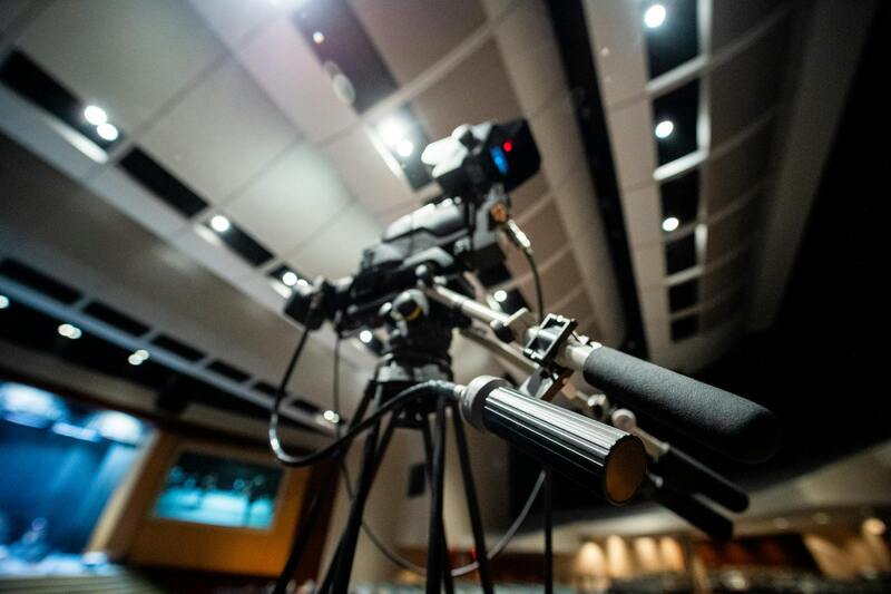
Executing drone photography for real estate listings in Miami requires adherence to specific guidelines that ensure safe and compliant operation. These procedures include obtaining necessary permissions, understanding airspace restrictions, and maintaining operational safety standards. Certified drone operators are familiar with the local regulations governing commercial drone use, which often involve registering the drone with relevant authorities and following defined flight protocols.
While the emphasis is on maintaining operational integrity, it is essential to work with reputable drone service providers who prioritize compliance and professionalism. Proper planning includes verifying insurance coverage, adhering to flight altitude limits, and respecting privacy boundaries of neighboring properties. Such measures not only uphold high standards in aerial photography but also foster trust among clients and stakeholders, reinforcing the integrity of marketing efforts.
Collaborating with experienced drone operators who are well-versed in local guidelines mitigates the risk of disruptions or legal issues. It also guarantees that the captured footage meets the standards necessary to boost property appeal and accurately reflect the listing’s features.
In the dynamic Miami real estate landscape, understanding and implementing proper regulatory practices for drone photography is essential. This approach ensures high-quality visual assets are produced within a framework that respects safety, privacy, and airspace management, ultimately contributing to the effective valuation and presentation of properties.
Choosing a Drone Production Agency in Miami
When selecting a drone photography provider for real estate listings in Miami, it is crucial to evaluate their technical expertise, experience in the industry, and adherence to operational standards. Reputable agencies invest in state-of-the-art equipment, ensure their pilots are certified, and follow best practices to deliver high-quality aerial imagery that effectively highlights property features and surrounding amenities.
In addition to technical competence, review the portfolio of previous projects. A seasoned agency will showcase a diverse range of successful real estate campaigns, demonstrating versatility and a keen understanding of what visual elements influence property valuation. Clients should seek agencies that offer comprehensive packages, including video tours, high-resolution images, and customized editing to optimize marketing impact.
Another critical factor is the agency's compliance with local operational guidelines, ensuring that all drone activities are conducted responsibly within the assigned airspace. Professional agencies also prioritize client communication, providing detailed pre- and post-flight reports to demonstrate the coverage and quality of captured footage. This transparency helps clients understand the value added by aerial photography and better assess the potential impact on property prices.
Evaluating the cost structure and delivery timelines of prospective agencies is equally important. An established Miami-based drone service can typically offer flexible scheduling, quick turnaround times, and competitive rates that make the investment worthwhile, especially considering the potential increase in property value and marketing effectiveness.
In sum, the ideal drone production partner for Miami real estate should blend technical proficiency, regulatory compliance, creative insight, and professional service. By choosing wisely, real estate professionals can leverage aerial imagery to elevate property listings, boost perceived value, and justify higher listing prices, ultimately ensuring a strong return on investment.