Overview of Drone Photography in Real Estate
Photographing properties from the air has revolutionized the way real estate marketing is conducted, providing potential buyers with a comprehensive view of a property’s layout and surroundings. Drone photography, utilizing advanced unmanned aerial vehicles, offers an elevated perspective that traditional ground-level photos cannot match. This innovative approach captures the property's intricate details, landscape, and neighborhood context, enhancing the overall appeal of listings.
In recent years, the adoption of drone technology in real estate has surged, driven by its ability to produce high-quality, visually stunning images and videos that attract more prospective buyers. By integrating aerial shots into marketing campaigns, real estate professionals can showcase properties in their full scope, highlighting outdoor amenities such as pools, gardens, or scenic views that often play a crucial role in the decision-making process.
Furthermore, drone photography facilitates a more detailed presentation of a property's features, offering potential buyers a clearer understanding of property boundaries, surrounding infrastructure, and landscape investment. This visual transparency aids in building trust and fosters quicker decision-making processes, ultimately increasing the likelihood of successful sales. As technology continues to advance, the capabilities of drone imaging expand, allowing more innovative and engaging visual content that can significantly influence a property's marketability.
For real estate agents and property developers, adopting drone photography services has become an essential component of modern property marketing strategies. This trend not only boosts visual impact but also enhances online listings, making them more engaging and accessible across digital platforms.
In an increasingly digital real estate landscape, employing high-quality aerial images and videos helps listings stand out in the competitive market, drawing more attention from potential buyers and accelerating sales cycles. Properly executed drone photography provides detailing and scale that conventional methods simply cannot match, transforming the way properties are showcased and marketed.
Equipment and Technology for Aerial Photography
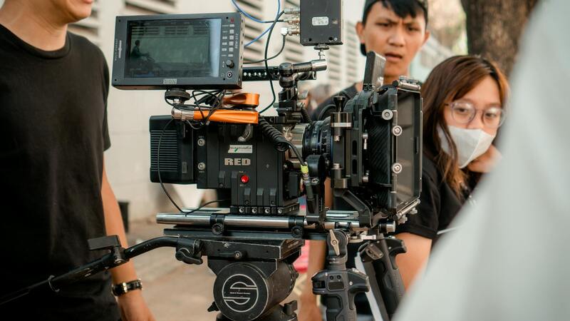
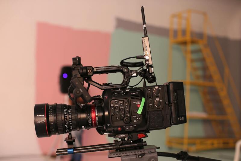
To capture high-quality drone real estate imagery, selecting the appropriate equipment and staying updated with the latest technological advances are essential. The primary components include durable, high-performance drones equipped with advanced cameras capable of capturing detailed images and smooth videos. For real estate applications, stabilized gimbals are crucial as they ensure steady footage, minimizing blur and shake during flight. High-resolution sensors, such as those found in professional-grade drones, enable the capture of crisp, vibrant images that effectively highlight the property's features. Additionally, the choice of lenses plays an important role. Wide-angle lenses allow for expansive shots that showcase the entire property and surrounding landscape, giving viewers a comprehensive perspective. Some drone systems come with adjustable aperture settings, enhancing image quality in varying lighting conditions. Flight controllers and GPS systems are integral to executing precise, safe, and repeatable flight paths. These features facilitate automated or semi-automated flight modes, enhancing efficiency and consistency across multiple shoots. Advanced drones also incorporate obstacle detection and collision avoidance technology, crucial for navigating complex environments and ensuring safety during operation. On the software side, flight planning tools and aerial imaging applications help streamline shoots, allowing operators to map out optimal flight routes in advance. This planning ensures comprehensive coverage of the property while minimizing flight time and battery consumption. Regarding data storage, professional drones support high-capacity memory cards that retain large, high-resolution media files. Coupled with reliable, high-capacity batteries, these systems support prolonged shooting sessions necessary for extensive property portfolios. In the pursuit of top-tier real estate imagery, investing in the right drone and ancillary equipment dramatically influences output quality and efficiency, ultimately enhancing marketing efforts.
Legal Regulations and Licensing Requirements
When deploying drone technology for real estate photography, understanding and adhering to the official guidelines for operation is essential. These regulations typically encompass specific standards for drone registration, operator certifications, and flight restrictions within certain areas. Acquiring the appropriate certifications demonstrates a commitment to safety and professionalism, ensuring that drone activities are coordinated effectively and responsibly.
Operators must be trained to understand the nuances of airspace management and the importance of maintaining visual line-of-sight during flights. This training often involves comprehensive instruction on airspace classifications, no-fly zones, and altitude limits, all designed to prevent interference with manned aircraft and other aerial activities.
In addition to operator certification, particular attention should be paid to local ordinances and municipal regulations that may influence drone operations in specific neighborhoods or districts. These guidelines are established to respect privacy concerns and community standards, shaping how aerial imagery can be captured and used for real estate marketing. For instance, drone flights near private properties often require prior permission from property owners, and certain restricted zones, like airports or sensitive environmental areas, are off-limits entirely.
Operational best practices involve scheduling flights during favorable weather conditions, planning comprehensive flight paths to maximize coverage, and employing backup systems to ensure data integrity. Maintaining accurate logs of flights and stored media supports accountability and helps streamline post-flight processes.
Furthermore, it is critical to stay informed about updates to drone policies and technology standards, as these can evolve rapidly. Regular training sessions and participation in industry forums help operators remain compliant with emerging best practices. Overall, robust knowledge of the official operational framework helps produce high-quality imagery while maintaining a safe and respectful relationship with the community.
Post-Processing and Editing of Aerial Real Estate Images
Post-processing is a vital stage in transforming raw aerial footage into stunning marketing assets that accurately represent a property's features and appeal. High-quality editing not only enhances visual clarity and color vibrancy but also ensures consistency across all media formats used in listing campaigns. This process begins with importing the captured images and videos into professional editing software, such as Adobe Lightroom or Photoshop for still images, and advanced video editing tools like Adobe Premiere Pro or Final Cut Pro for footage.
When editing aerial images, attention to framing and composition remains paramount. Adjustments to exposure, contrast, and saturation help bring out the true colors of the property and surrounding landscape, making the images more inviting. Correcting lens distortions, particularly when using wide-angle lenses common in drone photography, ensures straight lines and natural perspectives. This is especially important for architectural shots where accuracy in proportions enhances credibility.
Lighting and shadow corrections can also play a crucial role in highlighting property features effectively. For example, evening or dawn shots may require fine-tuned adjustments to emphasize the property against the sky. Additionally, stabilizing shaky footage or blurry images through software tools helps maintain a professional appearance. When creating virtual tours or video walkthroughs, the editing process may involve cuts, transitions, and overlays to create a seamless viewing experience.
Color grading can also be employed to evoke a specific mood or to align with branding standards. Consistent color palettes across photos and videos contribute to a cohesive marketing package. Additionally, remarketing images with informative overlays, such as text annotations or property details, can add value by providing viewers with immediate context. Final exports should adhere to optimal resolution standards for both online platforms and print materials, ensuring clarity and impact in every format used.
Across all editing stages, maintaining a balance between enhancement and authenticity is essential. Over-editing can misrepresent property features and erode viewer trust, so it’s crucial to deliver visually impressive yet truthful portrayals. Investing in post-processing expertise or partnering with skilled professionals ensures the imagery meets industry expectations and resonates with potential buyers.
Post-Processing Techniques for Optimized Real Estate Drone Imagery
Once the aerial footage and images are captured, the next essential step involves meticulous post-processing to ensure that the visuals are of the highest quality and effectively showcase the property's unique features. This stage encompasses a series of professional editing techniques tailored to enhance clarity, color accuracy, and visual appeal, all while preserving the authenticity of the property’s environment.
Color Correction and Grading
Applying precise color correction is crucial to achieve a natural and vibrant representation of the property. Adjustments to brightness, contrast, and saturation help accentuate key architectural elements and landscape features. Color grading can further be employed to evoke specific moods or highlight the property's best qualities, creating a cohesive visual narrative across all marketing materials.
Image Stabilization and Enhancement
Shaky footage or blurry images can detract from the overall professionalism of an aerial portfolio. Specialized software tools are used to stabilize footage, ensuring smooth, cinematic movement that captures the sweeping vistas or intricate architectural details. Sharpening filters and noise reduction techniques refine the image quality, enhancing the visual sharpness without overprocessing, which could distort the authenticity of the shot.
Stitching and Compositing
High-resolution drone images often require seamless stitching to produce comprehensive, panoramic views of entire properties or surrounding landscapes. Proper alignment and blending of multiple shots result in cohesive visuals that are ideal for virtual tours, brochures, or online listings. In some cases, compositing techniques are employed to combine elements from different shots, ensuring a comprehensive portrayal of the property and its environment.
Business Branding and Data Overlays
Incorporating overlays such as property details, location data, or branding elements can add informative value to aerial imagery. Careful placement and design optimize viewer engagement without cluttering the visual experience. These enhancements should complement the original footage, maintaining a balance between aesthetics and informative content.
Final Export and Format Optimization
The ultimate goal of post-processing is preparing visuals for various platforms and uses. Export settings are adjusted to meet resolution standards suited for online listings, social media, print advertisements, or virtual tours. Exporting in different formats ensures compatibility across devices and mediums, providing consistent quality for all marketing channels. Adhering to best practices in file compression guarantees high quality while maintaining manageable file sizes.
Through detailed post-processing, drone real estate imagery becomes a powerful tool in marketing properties. The meticulous attention to detail ensures visuals are compelling, accurate, and aligned with the overall branding strategy, thereby capturing the interest of prospective buyers effectively and professionally.
Officiating Drone Real Estate Photography: Approaches to Ensuring Proper Procedures
While the allure of capturing breathtaking aerial views is undeniable, executing drone real estate photography requires adherence to established methods that prioritize safety, accuracy, and professionalism. The primary approach involves utilizing certified drone operators who possess comprehensive knowledge of the technical capabilities and environmental considerations specific to aerial mapping. These operators typically undergo specialized training and certification processes that emphasize responsible flight practices, including maintaining safe distances from structures and respecting privacy boundaries.
Employing state-of-the-art drone technology ensures high-resolution imaging and stable footage, vital for highlighting the unique features of a property. Drones equipped with advanced stabilization systems and high-quality cameras can capture sharp, cinematic visuals even in challenging conditions. Strategically planning flight paths prior to shooting minimizes exposure to unnecessary risks and guarantees comprehensive coverage of the property and surrounding landscape.
Pre-flight planning is crucial and involves assessing airspace restrictions, weather forecasts, and property-specific factors such as potential obstacles or sensitive areas. This process often incorporates detailed site reconnaissance to determine optimal flight altitudes and angles, ensuring a variety of perspectives that showcase the property's full appeal. Moreover, maintaining meticulous records of flight logs, images captured, and technical details aligns with professional standards and facilitates smooth operations.
During actual shooting, operators should focus on consistent camera settings—such as aperture, shutter speed, ISO, and framing—to produce uniform images that can be seamlessly integrated into marketing materials. Utilizing automated flight modes for repetitive shots or panoramic capture can enhance efficiency while maintaining image quality. Post-flight, a thorough review and quality check of all imagery ensure only the best visuals are used in the final presentation.
Maintaining Standards and Transparency in Drone Real Estate Photography
Adopting an organized approach to drone operations also encompasses transparent communication with clients. Clear articulation of shooting techniques, deliverable timelines, and safety precautions fosters trust and sets realistic expectations. Maintaining compliance with official protocols underscores professionalism within the industry and exemplifies a commitment to ethical standards and high-quality service delivery.
In essence, methodical execution of drone real estate photography hinges on diligent planning, advanced technology utilization, adherence to safety procedures, and precise technical execution. These cohesive elements form the backbone of producing compelling, professional aerial visuals that significantly enhance real estate marketing efforts.
Choosing a Drone Production Agency in Miami
When selecting a drone photography agency for real estate in Miami, it is essential to prioritize providers that demonstrate proven expertise in aerial imaging and a deep understanding of the local market dynamics. A reputable agency will employ a team of certified drone operators who specialize in high-resolution real estate photography, ensuring that every shot captures the property’s true essence with precision and clarity.
Quality assurance is a key consideration. An experienced local agency should offer a comprehensive portfolio showcasing previous real estate projects, illustrating their capability to produce visually compelling images that highlight properties’ best features. This portfolio serves as an indicator of their technical proficiency, artistic vision, and familiarity with trending aesthetics in Miami’s property market.
Reliability and professionalism are equally important. An ideal drone photography partner maintains a consistent schedule, delivers edited content within agreed timelines, and communicates transparently throughout the process. They should also utilize state-of-the-art equipment featuring the latest drone models equipped with high-resolution cameras, advanced stabilization systems, and intelligent flight capabilities tailored to the demands of real estate imagery.

Additionally, adherence to safety standards and compliance with Miami’s aerial operation protocols further cement an agency’s reputation. Ensuring the agency’s pilots are licensed and follow established guidelines offers peace of mind, allowing real estate professionals to focus on showcasing properties without concerns over operational risks. Ultimately, selecting a local Miami drone production agency that combines technical excellence, experience, and professionalism enhances listing visibility, accelerates sales, and contributes to a compelling marketing strategy.
Future Trends in Drone Real Estate Photography
As the field of drone real estate photography continues to evolve, several emerging trends promise to enhance visual marketing strategies and provide a competitive edge for property listings. Innovations in technology, combined with advancements in image processing and data integration, are set to redefine how real estate professionals utilize aerial images to attract potential buyers. Here’s a detailed look at some key developments shaping the future of drone-based real estate visuals.
Enhanced Autonomous Flight Capabilities
We are witnessing a shift towards more autonomous drone operations, where sophisticated flight planning software enables drones to execute complex shooting paths with minimal human intervention. These intelligent systems can optimize flight routes for better coverage, avoid obstacles more effectively, and ensure consistent results across multiple listings. This technology reduces human error, accelerates the creation of high-quality images, and opens up new possibilities for dynamic, 360-degree aerial shots that can be seamlessly integrated into immersive virtual tours.
High-Resolution and HDR Imaging Advances
Future drone cameras will likely feature ultra-high-definition sensors capable of capturing detailed textures and colors that faithfully represent property features. High Dynamic Range (HDR) imaging, already prevalent in professional photography, will become more accessible in drone photography, allowing for balanced exposure in scenes with varied lighting conditions. This results in images that highlight property's architectural details and landscaping in stunning clarity, enhancing their visual appeal for online listings.
Artificial Intelligence and Automated Editing
The integration of artificial intelligence (AI) into post-production workflows is transforming how aerial images are processed. AI-driven editing tools can automatically correct distortions, enhance colors, and even suggest compositional improvements, streamlining the editing process. Automated tagging and metadata generation also facilitate better organization, indexing, and targeted marketing campaigns. These innovations ensure that high-quality, compelling visuals are delivered faster, allowing real estate agents to respond swiftly to market demands.
Integration of Real-Time Data and Live Streaming
Real-time data streaming capabilities enable live broadcasts of drone footage, providing virtual walkthroughs that can be shared instantly with prospective buyers. Combining live drone feeds with augmented reality overlays or interactive maps enhances the viewing experience, making virtual tours more engaging and informative. As technology progresses, real-time connectivity will become a standard feature, further bridging the gap between digital and physical property exploration.
Environmental and Regulatory Compliance Technologies
Emerging solutions aim to facilitate compliance with evolving operational protocols through advanced geofencing, automatic tracking, and flight restriction notifications. These systems help drone operators adhere to designated flight zones, avoid sensitive areas, and maintain data security. Such tools promote safe, efficient operations that respect community standards and environmental considerations, ensuring that aerial marketing remains a responsible practice.
Overall, the future of drone real estate photography is poised to become more autonomous, precise, immersive, and integrated with cutting-edge digital tools. Property marketers leveraging these innovations will be able to produce more engaging visual content, delivering immersive experiences that drive interest and expedite sales in Miami's dynamic real estate market.