Overview of 3D Drone Photography
3D drone photography represents a significant advancement in aerial imaging technology, combining the agility and perspective of unmanned aerial vehicles (UAVs) with sophisticated three-dimensional mapping techniques. By utilizing specialized equipment and software, this method captures detailed, high-resolution images and spatial data, which are then rendered into accurate 3D models. These models offer a comprehensive view of structures, landscapes, and urban environments, making them invaluable across various sectors.
In modern industries, 3D drone photography enhances visualization, planning, and decision-making processes. It allows professionals to obtain a comprehensive geographical perspective without the need for traditional, often labor-intensive methods. From construction sites to real estate developments, this technology provides precise measurements, detailed surface mapping, and dynamic visualizations that were previously challenging to produce efficiently. Its ability to generate accurate 3D representations from aerial data reduces the risk of errors and improves planning accuracy, ultimately saving time and costs.

The relevance of 3D drone photography continues to grow as industries recognize its potential to revolutionize traditional methods. In construction, it facilitates site surveys, progress tracking, and precision planning. In urban development, it aids in infrastructure assessments and city modeling. The technology's capacity to deliver real-time, immersive visual data enhances safety protocols and project oversight, making it a critical component of modern visual documentation and spatial analysis.
Unlike standard 2D aerial photography, 3D imaging enables in-depth analysis and more accurate measurements, providing stakeholders with a clear understanding of spatial relationships and topographical nuances. As an adaptive solution, it supports both large-scale projects and detailed inspections, ensuring stakeholders can make well-informed decisions based on comprehensive, reliable data.
Types of 3D Drone Imaging Technologies
Multiple advanced imaging technologies are employed in 3D drone photography, each offering unique benefits tailored to specific project needs. Among these, photogrammetry remains the most widely used method. It involves capturing overlapping images from various angles and processing them through specialized software to generate highly detailed 3D models. This technique allows for precise surface modeling and terrain analysis, making it ideal for construction progress monitoring, land surveying, and environmental assessment.
Another prominent technology is Light Detection and Ranging (LiDAR). LiDAR employs laser sensors mounted on drones to emit rapid laser pulses towards surfaces. These pulses reflect back and are captured by sensors, creating an extensive point cloud that accurately measures distances to surfaces regardless of lighting conditions. LiDAR is particularly useful in dense forest environments, complex urban landscapes, and topographical mapping, offering excellent penetration through foliage and delivering high-precision data.
Structured light technology is another innovative approach, primarily used for precision-inspection scenarios. It involves projecting a known light pattern onto objects and measuring the deformation of the pattern to reconstruct detailed 3D surfaces. This method is particularly effective for inspecting intricate structures, manufacturing components, or architectural features where microscopic accuracy is necessary.
Each of these technologies supports different project demands. Photogrammetry offers cost-effective, high-resolution 3D data for extensive areas, while LiDAR provides superior accuracy and penetration capabilities in complex environments. Structured light excels for detailed, close-range inspections where surface complexity is high. Combining these methods can optimize results across diverse applications, leveraging their respective strengths for improved precision and efficiency.
Overview of 3D Drone Photography
3D drone photography has become an essential component for a wide range of professional fields, leveraging advanced aerial imaging technologies to produce highly detailed three-dimensional visuals. Unlike traditional photography, this technique captures intricate surface details, spatial relationships, and topographical features with extraordinary accuracy, offering comprehensive insights into the surveyed area. By utilizing specialized equipment mounted on portable flying platforms, 3D drone photography provides a new perspective that enhances planning, analysis, and presentation across industries such as construction, real estate, media, and environmental management.
The core advantage of 3D drone photography lies in its ability to capture multiple overlapping images from various angles during flight. These images are then processed using sophisticated software algorithms to generate precise three-dimensional models. This process, often termed photogrammetry, involves analyzing the parallax differences between images to determine the exact positioning of objects and surfaces within the scene. The resulting 3D models include detailed surface textures, elevation data, and spatial measurements, making them invaluable for detailed mapping and site analysis.
The seamless integration of high-resolution cameras and GPS-enabled drones ensures that 3D surveys are both accurate and efficient. These capabilities allow professionals to visualize terrain changes over time, spot structural anomalies, or plan construction phases with precise spatial awareness. Moreover, the non-intrusive nature of drone-based data collection minimizes disturbance to ongoing operations, making this technology highly suitable for sensitive environments and dynamic urban settings.
Types of 3D Drone Imaging Technologies
Advancements in drone imaging encompass several sophisticated methods designed to meet diverse project requirements. Each technique offers unique benefits in terms of detail, accuracy, and application scope, enabling professionals to select the most suitable approach for their specific needs.
Photogrammetry remains the predominant method for capturing large-scale 3D data through the processing of overlapping images. This technique is highly adaptable, cost-effective, and particularly suited for extensive terrain mapping, construction site documentation, and architectural visualization. It generates high-resolution 3D point clouds and textured models, easily integrated into GIS and CAD systems for subsequent analysis.
LiDAR (Light Detection and Ranging) employs laser sensors to measure surface distances and produce detailed point clouds with exceptional depth penetration capabilities. This technology excels in complex environments such as dense forests or urban areas with obstructed views, providing accurate topographical data even under challenging lighting conditions. LiDAR-equipped drones are invaluable for detailed terrain analysis, environmental studies, and infrastructure assessment.
Structured Light Technology involves projecting a precise light pattern onto an object and analyzing deformations to reconstruct its surface. This method is highly effective for fine-detail inspections of structures, manufacturing components, or architectural features requiring microscopic precision. Its primary advantage is delivering ultra-detailed surface information at close range, making it ideal for quality control and detailed inspection scenarios.

Equipment and Software Requirements
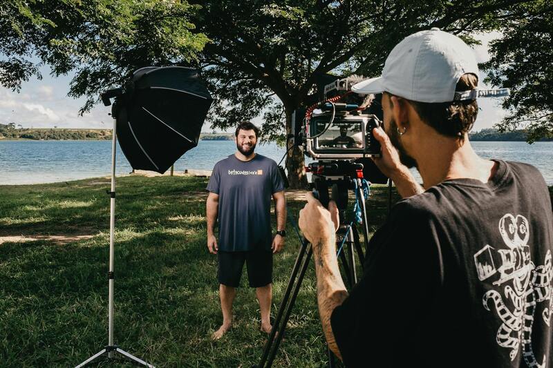
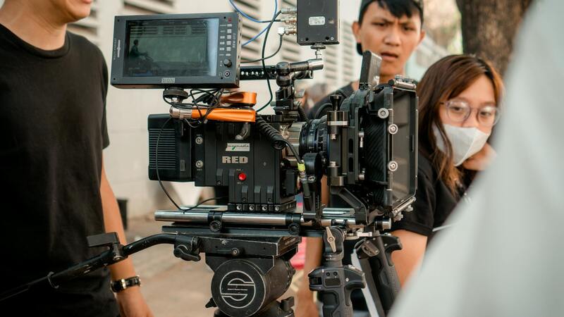
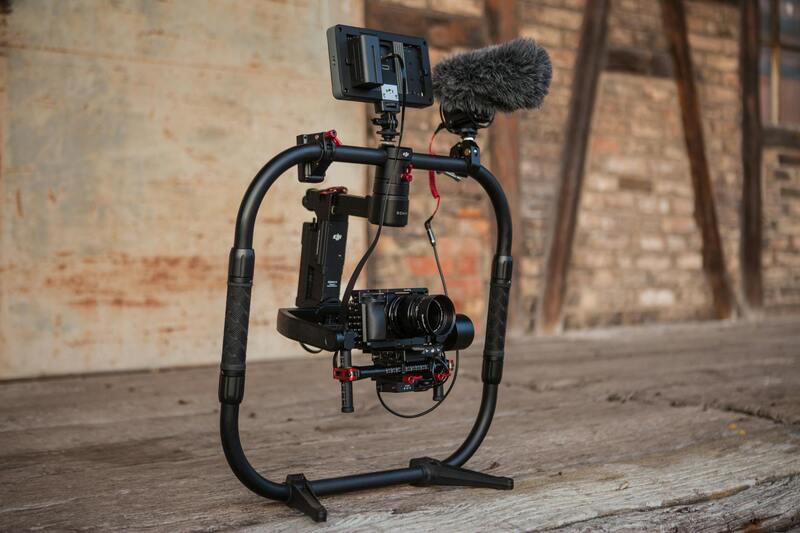
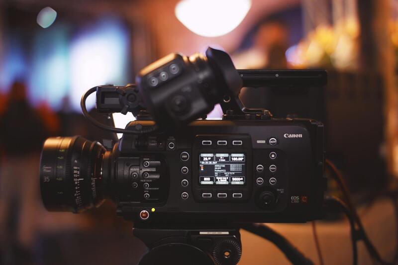
Executing successful 3D drone photography projects demands specialized hardware and software to capture, process, and analyze the data collected during flights. High-quality drone platforms equipped with stabilized gimbals ensure image clarity and consistency, essential for detailed 3D reconstructions. Combining these with advanced cameras, such as high-resolution RGB sensors, multispectral, or LiDAR sensors, expands the scope and accuracy of data acquisition.
Post-flight processing involves software solutions capable of handling large datasets and generating usable 3D models. Photogrammetry software like Agisoft Metashape, Pix4Dmapper, or DroneDeploy enables automatic alignment of images, point cloud generation, and textured mesh creation. These tools often include modules for georeferencing, ensuring that the models accurately reflect real-world coordinates, essential for precise measurements and mapping. Additionally, CAD and GIS integration tools facilitate further analysis, planning, and presentation.

Equipment and Software Requirements for High-Quality 3D Drone Photography
Achieving precise and detailed 3D drone imagery hinges on the integration of sophisticated hardware and software tools. The foundation of a successful 3D drone photography project begins with selecting high-performance drone platforms. These platforms should feature stabilized gimbals that ensure steady image capture, minimizing motion blur and enhancing the sharpness of each shot. This stability is critical for generating accurate 3D models, especially when dealing with complex structures or terrain.
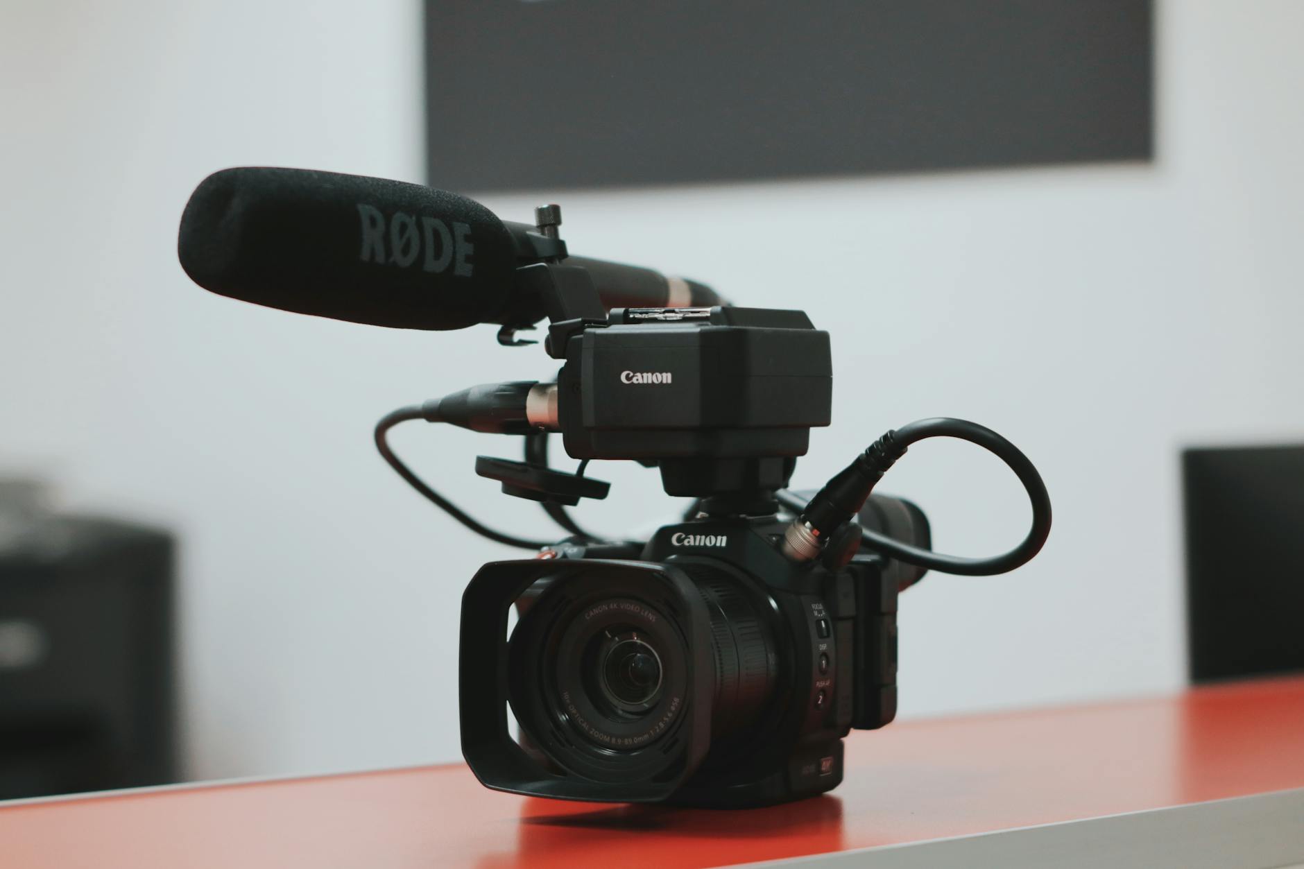
For data acquisition, high-resolution cameras are indispensable. Canon, Sony, and other professional-grade RGB sensors are commonly used due to their ability to capture crisp, true-to-life imagery. Expanding beyond traditional visual spectrum imaging, multispectral sensors can be employed for specialized applications such as environmental monitoring or agricultural analysis, while LiDAR sensors offer unparalleled detail when creating topographical and surface models by capturing millions of precise distance measurements.

Post-capture processing environments involve robust software solutions capable of handling vast amounts of data and converting it into usable formats. Photogrammetry software like Agisoft Metashape and Pix4Dmapper automate the process of image alignment, point cloud generation, and textured mesh creation. These platforms support georeferencing, ensuring that the resulting 3D models correspond accurately to spatial coordinates, which is vital for precise measurements and mapping.
Further integration with Geographic Information Systems (GIS) and Computer-Aided Design (CAD) tools enables detailed analysis and detailed presentations of the models. These software packages facilitate tasks such as volume calculations, structural analysis, and overlaying of additional data layers, thereby enhancing the utility of 3D imagery across various industries.
The effectiveness of a 3D drone photography project depends heavily on the synergy between hardware and software. Investing in reliable, high-quality equipment coupled with advanced processing platforms ensures that data collection and interpretation meet professional standards, resulting in highly accurate and visually compelling 3D representations that serve diverse operational needs in construction, real estate, media production, and environmental management.
Implementation of 3D Drone Photography in Construction and Real Estate Sectors
In the dynamic fields of construction and real estate, the adoption of 3D drone photography has revolutionized project visualization and site management. Utilizing high-resolution imaging combined with precise 3D mapping, professionals can develop accurate models of properties, construction sites, and surrounding environments. This technology facilitates comprehensive site assessments, progress tracking, and enhanced client presentations, ultimately leading to more informed decision-making processes.
Construction managers leverage 3D drone imagery to monitor ongoing work, detect potential issues early, and ensure that projects adhere to planned timelines and budgets. The ability to capture detailed topographic data assists in planning excavation, grading, and foundation work with a higher degree of accuracy. Moreover, 3D models created from drone data can be integrated into Building Information Modeling (BIM) systems, providing a seamless link between site reality and digital design plans.
In real estate, these technologies enable the creation of immersive virtual tours and interactive property models that showcase listings more effectively. Potential buyers and investors can explore properties from any location with detailed 3D reconstructions, enhancing marketing reach and engagement. For developers, 3D drone data supports site analysis, zoning compliance, and visualization efforts, which are instrumental in securing permits and attracting investment.
Successful deployment in these sectors hinges on integrating precise data capture with sophisticated processing workflows. Accurate drone flights, optimal image overlap, and the use of advanced photogrammetry software ensure the generation of detailed, georeferenced 3D models. These models not only improve operational efficiencies but also enhance stakeholder communication and project transparency.
As this technology continues to evolve, its role in construction and real estate is expected to expand further, supporting more complex analyses such as volumetric measurements, structural inspections, and environmental impact assessments. Utilizing professional-grade equipment and adhering to established data collection protocols are essential to maximize the benefits of 3D drone imagery in these applications.
Equipment and Software Requirements
Executing high-quality 3D drone photography necessitates a combination of advanced hardware and sophisticated software solutions. Precision and consistency in data acquisition are foundational to producing accurate 3D reconstructions that meet professional standards across various industries.
Drone Hardware
- High-Resolution Cameras: Industry-grade drones are equipped with high-resolution digital cameras, often with 20MP or higher sensors, capable of capturing detailed imagery essential for photogrammetric processing.
- Gimbals and Stabilizers: To prevent motion blur and maintain image clarity, gimbals stabilize cameras during flight, ensuring sharp, evenly framed photographs from multiple angles.
- GPS and RTK Modules: Real-Time Kinematic (RTK) positioning systems dramatically improve georeferencing accuracy, enabling precise mapping and modeling that align with real-world coordinates.
- Autonomous Flight Capabilities: Autonomous flight controllers facilitate planned, repeatable flight paths with controlled overlap and coverage, optimizing data collection efficiency.
Photogrammetry and Processing Software
Transforming images into 3D models relies on advanced software capable of processing large datasets with high precision. Notable options include:
- Agisoft Metashape: Widely used for photogrammetric processing, offering 3D model generation, orthomosaics, and textured mesh creation with extensive control over processing parameters.
- Pix4Dmapper: Provides robust features for detailed 3D reconstructions, volumetric analysis, and georeferenced mapping, with user-friendly workflows suitable for professionals.
- DroneDeploy: Cloud-based platform that streamlines image processing, asset management, and sharing, facilitating collaborative workflows and rapid generation of 3D models.
Integration and Data Management
Effective 3D drone photography also requires secure data management platforms that support integration with GIS, BIM, or CAD systems. Ensuring proper data storage, backup, and systematic processing protocols enhances workflow efficiency and data integrity.
Legal and Safety Considerations in 3D Drone Photography
Implementing 3D drone photography in professional projects necessitates adherence to established operational standards to ensure safety and compliance with airspace regulations. This involves a thorough understanding of local airspace restrictions, altitude limits, and no-fly zones, particularly in densely populated urban areas such as Miami. Operators must obtain the necessary permissions from relevant authorities before executing aerial surveys or capturing imagery in sensitive locations.
Maintaining clear communication with local aviation agencies and staying updated on changing regulations helps mitigate risks during drone operations. Additionally, developing comprehensive risk assessments and safety protocols is vital for addressing potential hazards such as wildlife disturbance, collision avoidance, and interference with manned aircraft. Employers should also ensure that drone pilots are well-trained, certified, and familiar with emergency procedures, including safe landing protocols and response strategies for unexpected obstacles or system malfunctions.
Using high-quality, well-maintained equipment reduces the likelihood of technical failures that could compromise safety or data accuracy. For instance, equipped with obstacle detection sensors and return-to-home features, modern drones enhance operational safety during complex 3D imaging tasks. These safety features are particularly important when navigating challenging environments or operating at higher altitudes.
In cases where 3D drone photography involves capturing images of private property, respecting privacy rights is essential. operators should establish clear boundaries and inform property owners beforehand, avoiding intrusive or unauthorized imaging. Incorporating geo-fencing technology can help restrict drone operations within designated zones, preventing accidental encroachments.
Furthermore, maintaining detailed logs of flight activities, including flight paths, weather conditions, and data collected, supports accountability and quality control. Regular calibration and maintenance of drone systems ensure reliable performance and data integrity, which are indispensable for producing accurate 3D models.
By prioritizing safety and adhering to operational standards, professionals can utilize 3D drone photography to its fullest potential while minimizing risks and supporting sustainable, responsible practices. This approach not only enhances project reliability but also fosters trust among clients and stakeholders involved in diverse industries.
Legal and Safety Considerations in 3D Drone Photography
Implementing 3D drone photography responsibly requires adherence to established guidelines that prioritize safety, privacy, and data accuracy. Drone operators must ensure that their equipment meets the necessary standards for capturing high-quality 3D images while maintaining operational safety. This involves routine checks on drone calibration, sensor functionality, and camera alignment to guarantee precise data collection and model accuracy.
In complex environments such as urban settings or construction sites, maintaining situational awareness is vital. Operators should conduct pre-flight risk assessments to identify potential obstacles like power lines, tall structures, or crowded areas. Utilizing obstacle detection sensors and automatic collision avoidance systems can significantly mitigate the risk of accidents, aiding safe navigation through intricate environments.

Operational safety is further supported by establishing clear flight plans and designated no-fly zones. Implementing geo-fencing technology ensures drones operate within predefined boundaries, preventing unwanted encroachments into restricted areas such as private properties or sensitive locations.
Pilot certification and ongoing training are essential components for safe drone operation. Certified pilots understand the nuances of airspace regulations and mohou adapt dynamically to changing conditions. Additionally, maintaining detailed flight logs—including altitude, weather conditions, and imaging parameters—serves multiple purposes: it aids in accountability, facilitates troubleshooting, and helps improve future operations.
Data Privacy and Ethical Guidelines
Protecting the privacy rights of individuals and property owners is a key aspect of responsible 3D drone imaging. Operators should communicate clearly with property stakeholders and obtain necessary permissions before commencing flights in private areas. Implementing geo-fences and temporary operational zones can help prevent unintentional data collection beyond authorized boundaries.
Ensuring data security and integrity during storage, transfer, and processing is equally important. Utilizing encrypted channels and secure servers minimizes risks associated with data breaches or unauthorized access. When processing 3D imagery, data analysts and technicians must exercise adherence to ethical standards, avoiding distortions or misrepresentations of captured environments.
Technological Innovations Driving Safety and Compliance
Emerging advancements such as AI-driven flight path optimization and real-time data validation enhance both safety and effectiveness in 3D drone projects. These technologies allow drones to adapt to dynamic conditions, like sudden weather changes or unexpected obstacles, reducing the likelihood of mishaps. Moreover, integrated software solutions enable comprehensive compliance monitoring, ensuring every flight adheres to operational protocols and regulatory expectations.