Overview of 3D House Photography
3D house photography has transformed the visual presentation of properties by offering detailed, immersive experiences that go beyond traditional images. This innovative imaging technique captures the spatial layout, architectural details, and interior design of a property with exceptional accuracy. Utilizing advanced camera systems and software, 3D house photography allows potential buyers and renters to virtually explore a home from any location, providing a comprehensive understanding of its spatial dynamics without physically visiting the site.
In the Miami real estate market, where luxury properties and high-end developments are prominent, 3D house photography has become an invaluable tool. The vibrant and diverse Miami property landscape benefits significantly from this technology, enabling real estate professionals to showcase properties in a manner that appeals to international buyers and remote investors. The ability to present detailed, interactive tours enhances engagement, accelerates decision-making processes, and broadens marketing reach across digital platforms.
In essence, 3D house photography bridges the gap between traditional listing photos and in-person viewings. It offers a visual experience that captures the true essence and spatial nuances of a property, making it easier for buyers to visualize living in the space. This technology's growing relevance is rooted in its ability to present properties more professionally, increase online engagement, and ultimately lead to faster sales or rentals in competitive markets like Miami.
Key Technologies Behind 3D House Photography
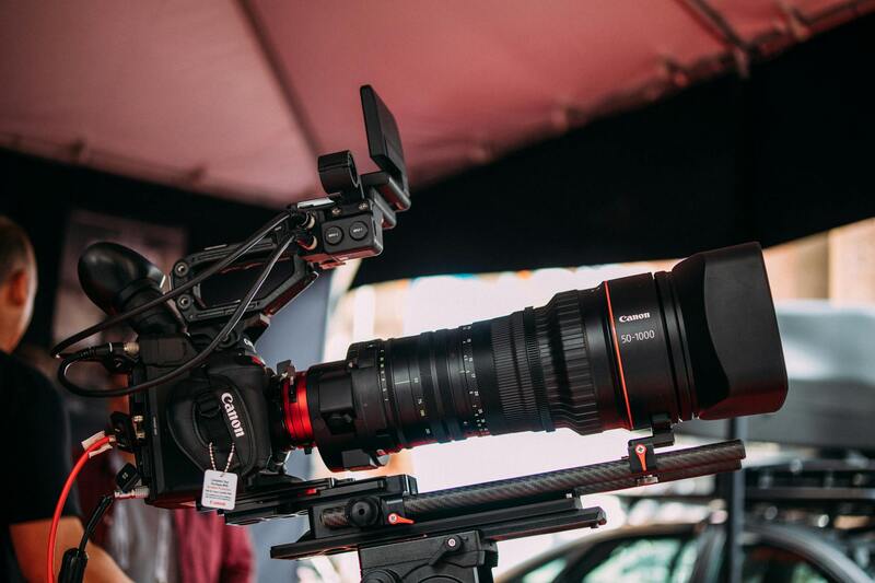
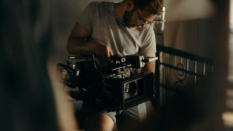
Fundamental to the creation of high-quality 3D house images are a combination of sophisticated hardware and advanced software solutions. At the core, specialized 3D scanning equipment, such as laser scanners and high-resolution panoramic cameras, are employed to capture detailed spatial data of the property. These devices generate point cloud data and high-definition images that form the basis for the 3D models, ensuring every architectural detail, from the ornate molding to the subtle curvature of walls, is accurately represented.
Moreover, cutting-edge software plays a pivotal role in processing raw capture data. Photogrammetry software algorithms analyze the multitude of images taken from various angles to construct precise 3D models. These programs automate the stitching together of images, rendering interactive models that can be navigated smoothly by users. They also incorporate features like automatic alignment, color correction, and texture mapping, which enhance realism and visual appeal.
Another vital component is the integration of virtual reality (VR) and augmented reality (AR) platforms, allowing stakeholders to immerse themselves fully in the property's virtual environment. VR headsets and AR applications provide a more interactive experience, enriching the viewing process. This technological synergy allows real estate professionals to present properties with unprecedented clarity, making the virtual exploration as engaging and realistic as an in-person visit.
In Miami's competitive real estate market, the deployment of these sophisticated technologies is increasingly becoming a standard practice. They empower agents to generate compelling, accurate representations of property layouts and design features, which are crucial for attracting discerning clients and international investors. As technological advancements continue to evolve, the precision and efficiency of 3D house imaging are expected to improve further, solidifying its role as a cornerstone of modern property marketing strategies.
Key Technologies Behind 3D House Photography
Implementing high-quality 3D house photography relies on a diverse array of advanced tools and software that ensure precision, immersion, and efficiency. Central to this technology stack are laser scanning devices, such as LiDAR (Light Detection and Ranging) sensors, which capture millions of data points with remarkable accuracy. These devices generate detailed point clouds that serve as the foundation for constructing comprehensive 3D models of properties.
Alongside laser scanners, photogrammetry software plays a vital role. This technique involves capturing multiple overlapping images from various angles and software algorithms process these images to produce dense, textured 3D models. Popular photogrammetry tools include proprietary solutions tailored for real estate, which automate the stitching, alignment, and texture mapping processes, resulting in highly realistic virtual representations.

Moreover, visualization applications incorporate advanced rendering engines, capable of simulating natural lighting, shadows, and material reflections to produce lifelike images. These engines facilitate real-time navigation within the 3D environment, allowing viewers to virtually walk through a property as if they were physically present.
Virtual and augmented reality platforms are also integral to delivering immersive property experiences. VR headsets and AR applications enable clients, investors, and other stakeholders to explore properties interactively, gaining a clear understanding of spatial dynamics and interior layouts. These innovations are driven by seamless integration of hardware and software, leveraging powerful processors and cloud computing to handle large datasets efficiently.
As the capabilities of these technologies progress, the complexity and realism of 3D property models continue to improve. This ongoing innovation not only accelerates the creation process but also enhances the overall visual accuracy, making 3D house photography an indispensable element of contemporary real estate marketing strategies.
Best Practices for Capturing 3D House Photos
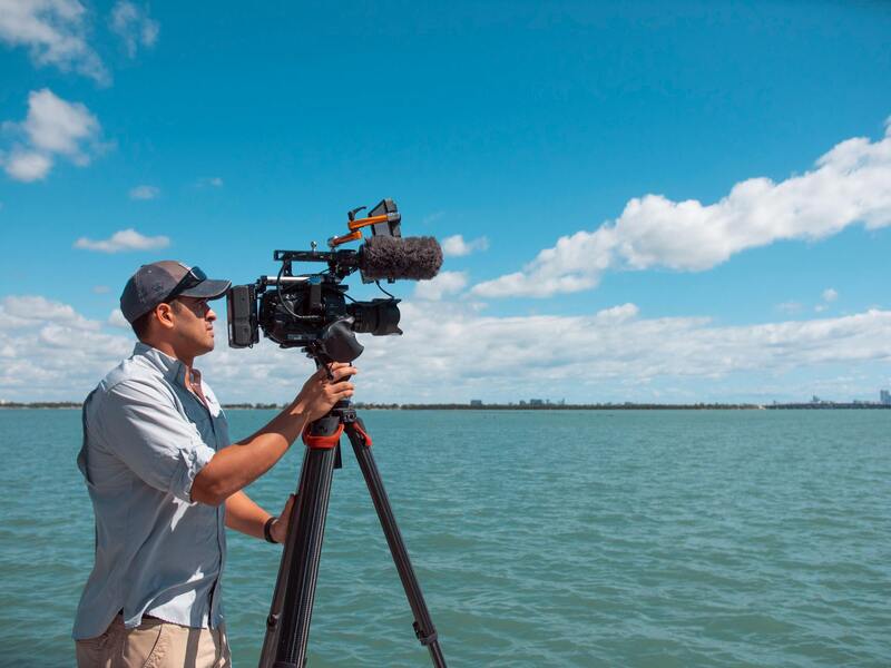
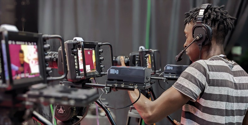
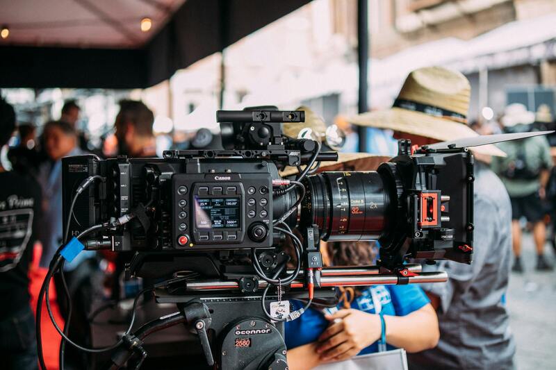
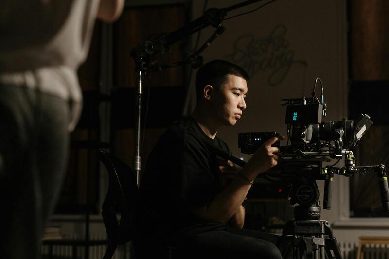
To maximize the effectiveness of 3D house photography, it is essential to adhere to specialized capturing techniques that ensure detailed, accurate, and compelling virtual representations of properties. Selecting the right equipment is foundational; high-resolution 3D cameras equipped with panoramic stitching capabilities provide the clarity necessary for immersive virtual tours. Proper camera placement and consistent lighting are critical components, as they influence the accuracy of spatial relationships and the overall realism of the images.
When capturing 3D images, maintain a steady camera setup, ideally using tripods or stabilized mounts, to prevent distortions or misalignments in the final model. It is advisable to photograph from multiple angles and vantage points within each room, emphasizing key features such as architectural details, natural light sources, and unique property amenities. Overlapping shots should be carefully captured to facilitate seamless stitching during post-processing.
Ensuring optimal lighting conditions is vital for high-quality 3D imaging. Natural daylight, complemented with controlled artificial lighting if necessary, reduces shadows and enhances the visibility of textures and surface details. Avoid overly harsh or uneven lighting that could obscure important features or create artificial shadows.
Post-capture, the data must be processed using professional-grade software that supports detailed alignment, texture mapping, and mesh generation. Properly calibrated workflows help maintain the integrity of the virtual model's geometry, ensuring that the virtual walkthrough feels authentic and accurate. Consistency in image quality and processing standards across all marketing materials enhances brand reliability and customer trust.
Additionally, integrating the 3D capture process with broader marketing efforts—such as preparing virtual tours, interactive floor plans, and online listings—can create a cohesive presentation strategy. Striving for smooth, thorough, and high-quality 3D imaging ensures that potential buyers experience the property as fully as possible before visiting, thereby increasing engagement and interest in the listing.
Key Technologies Behind 3D House Photography
Advancements in digital imaging and computational processing have revolutionized the way properties are showcased through 3D house photography. Core technological components include high-resolution laser scanners, advanced cameras equipped with wide-angle lenses, and sophisticated software algorithms that generate detailed virtual models. These tools work together to capture spatial data and surface textures with remarkable precision, creating immersive virtual representations that can be explored interactively.
LiDAR (Light Detection and Ranging) sensors are a pivotal element, allowing for rapid collection of dense point cloud data. When combined with high-definition photography, this data forms the geometric framework of the virtual model. Such accuracy ensures that each measurement and detail accurately reflects the physical properties of the real estate, from architectural features to interior textures.
Software solutions then process this collected data, performing tasks such as alignment, mesh reconstruction, and texture mapping. These processes synthesize the raw data into navigable 3D models, which can be viewed from multiple angles, providing prospective buyers with a comprehensive understanding of the layout and design of the space.
Additional technological enhancements include the integration of drone-captured imagery for exterior views, panoramic cameras for expansive interior shots, and cloud-based storage solutions that facilitate seamless sharing and editing of large datasets. These innovations ensure that the virtual walkthroughs are not only photorealistic but also efficiently produced and easily accessible for marketing purposes.
- Laser Scanning: Provides precise spatial data in seconds, capturing detailed geometry of complex structures.
- High-Resolution Imaging: Ensures textures and surface details are accurately represented, enhancing realism.
- Software Algorithms: Enable alignment, filtering, and mesh generation, transforming raw data into coherent models.
- Cloud Computing: Enhances data processing speed and allows for remote editing and sharing of 3D models.
Continued innovation in sensor miniaturization, processing power, and AI-driven analysis promises to further elevate the quality, efficiency, and accessibility of 3D house photography. These technological advancements ensure that real estate professionals can deliver more engaging and reliable virtual representations to potential clients.
Best Practices for Capturing 3D House Photos
Achieving high-quality 3D house photographs requires meticulous planning, precise equipment setup, and an understanding of optimal shooting techniques. The accuracy and realism of the final virtual models depend heavily on adherence to industry-established best practices that ensure consistency, detail, and clarity in the captured data.
Preparation for 3D House Photography
- Scene Assessment: Prior to photography, conduct a thorough walkthrough of the property to identify ideal angles and spaces with balanced lighting conditions. Clear clutter and ensure all relevant areas are accessible for scanning or imaging.
- Lighting Optimization: Proper lighting is crucial for capturing textures and surface details. Use consistent, diffuse lighting to minimize shadows and glare, especially in interior spaces. Avoid shooting during times of day with harsh sunlight that might cause uneven exposure.
- Equipment Calibration: Regularly calibrate laser scanners, panoramic cameras, or drones to ensure accuracy. Keep equipment clean and in optimal working condition to prevent artifacts or data loss during scanning.
Strategic Camera Placement and Scanning
Accurate data collection begins with strategic placement of capturing devices. For interior spaces, position scanners or cameras at balanced vantage points that encompass maximum detail while avoiding occlusions. In exterior shots, select elevated viewpoints that highlight key structural features or surrounding landscape. The following practices improve data fidelity:
- Multiple Scans from Different Angles: Perform overlapping scans or images to ensure comprehensive coverage. This redundancy allows software algorithms to accurately align and mesh the data, reducing gaps and distortions.
- Consistent Overlap: Maintain transparency with overlap margins—typically 30-50%—to facilitate smooth stitching and model generation.
- Use of Tripods and Stabilizers: During handheld scans or panoramic captures, stabilize equipment to prevent motion artifacts that compromise model precision.
Post-Processing for Enhanced Quality
Once data collection is complete, dedicated software tools are employed to refine the 3D models. Key steps include:
- Data Alignment and Registration: Ensure that multiple datasets align seamlessly, correcting any misregistrations or distortions.
- Noise Filtering and Surface Smoothing: Remove extraneous data points or artifacts that may detract from model realism.
- Texture and Surface Detailing: Apply high-resolution surface textures to enhance visual accuracy and realism.
Ensuring Consistency and Quality Control
Regular checks during the capture process, including reviewing initial images or scans, help identify issues early. Consistency in image quality and coverage is essential for creating cohesive virtual walkthroughs that meet high standards of professionalism. Implementing standardized protocols across multiple properties ensures a reliable and efficient workflow, enabling real estate professionals to deliver compelling, immersive experiences that resonate with potential buyers.
Optimizing Capture Techniques and Data Processing for Superior 3D House Models
Achieving high-quality 3D house photography requires meticulous attention to both capture methods and subsequent data processing. Precision during data collection directly influences the accuracy and visual appeal of the final model. Employing consistent capture protocols, such as maintaining appropriate overlap margins—typically between 30-50%—ensures comprehensive coverage and facilitates seamless stitching during model reconstruction. This overlap allows software algorithms to align and register multiple images accurately, reducing errors and distortions in the 3D representation.
Utilizing stabilization tools like tripods and handheld stabilizers minimizes motion artifacts that can compromise the clarity and detail of the scans. Stabilization is especially critical in environments with variable lighting or limited space where camera or scanner movement might occur. Proper positioning of cameras or 3D scanning devices is essential; strategic placements should maximize coverage of key features while minimizing blind spots, ensuring that every nook and cranny of the property is captured with sufficient detail.
Post-capture processing plays an equally vital role in producing professional-grade 3D models. Data alignment involves merging multiple scans or images into a cohesive, unified model, correcting for any misalignments to achieve spatial consistency. Noise filtering processes remove extraneous data points, such as random artifacts caused by reflections or environmental factors, which can detract from the model’s authenticity. Surface smoothing algorithms further refine the visual presentation, eliminating irregularities and creating a polished appearance.
High-resolution texturing and surface detailing are applied during post-processing to enhance realism. These techniques involve overlaying detailed textures that mimic the actual surfaces within the property, from wall finishes to flooring materials. Such enhancements help potential buyers visualize the space more effectively and foster a stronger emotional connection to the property.
Regular quality control checks are imperative throughout the capture and processing phases. Initial reviews of images or point cloud data can identify issues such as incomplete coverage or misalignments early on, enabling immediate corrective actions. Consistency in quality ensures the final virtual walkthroughs are cohesive and professional, reflecting the property’s true appeal. Adopting standardized procedures across multiple projects not only streamlines workflows but also guarantees that each property is presented in the best possible light, maximizing engagement and interest from prospective buyers.
Advanced Techniques and Limitations of 3D House Photography
While 3D house photography offers numerous advantages, it is essential to understand its sophisticated methods and inherent constraints to optimize results. This technology relies heavily on precise scans, high-quality equipment, and expert handling to produce immersive virtual walkthroughs that meet industry standards. The core techniques include laser scanning and photogrammetry, both of which serve to capture detailed spatial data and textures. Laser scanners emit rapid pulses of light to record distances and generate point clouds that accurately represent the physical environment. Photogrammetry, on the other hand, involves capturing multiple overlapping photographs from different angles and processing them through specialized software to create textured 3D models.
Despite their sophistication, these methods are subject to certain limitations. Small, reflective, or transparent surfaces can interfere with laser scans, resulting in data gaps or inaccuracies. Lighting conditions, such as glare or shadows, may compromise the quality of photographic data, especially in photogrammetry-based approaches. Additionally, spaces with complex architectural features or tight angles can pose challenges in achieving comprehensive coverage. High ceilings, intricate moldings, or ornate fixtures require meticulous scanning angles and additional equipment to capture all details correctly.
Environmental factors can also influence the accuracy of 3D models. Excessive clutter, movement within the property during scanning, or external weather conditions such as rain and wind can hinder data acquisition. Furthermore, processing large datasets demands significant computational resources, which may extend project timelines. While advancements are continually being made to mitigate these issues, it remains crucial for professionals to understand and adapt to these constraints for optimal output.
Technological Innovations Addressing Limitations
- Improved scanner accuracy: New generation laser scanners and multi-sensor systems enhance data precision and reduce artifacts caused by reflective or transparent surfaces.
- Enhanced software algorithms: AI-driven processing tools now better interpret complex geometries, fill data gaps, and automate error correction.
- Faster data processing: Cloud computing and dedicated high-performance workstations significantly cut down the time required for model refinement and rendering.
- Hybrid capture techniques: Combining laser scanning with photogrammetry allows for more flexible data collection, especially in difficult environments or spaces requiring detailed textures.
Understanding these advanced methods and their limitations guides professionals towards strategic planning and execution, ensuring that 3D house photography effectively elevates property marketing efforts while managing project complexities efficiently.